place

Bowen Island Ferry

Bowen IslandFerries of British ColumbiaFerry companies of British ColumbiaTransport in West Vancouver
BC Ferries Zone Two
BC Ferries Zone Two

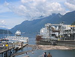
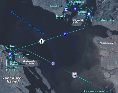
The Bowen Island ferry travels between Snug Cove on Bowen Island, and Horseshoe Bay in the District of West Vancouver, British Columbia, Canada, a trip of three nautical miles across Queen Charlotte Channel. A scheduled ferry has been in operation since 1921, when Bowen Island was a popular holiday destination. Prior to that year, transportation to the island was by steamship from Vancouver, with only one trip daily. The Bowen Island ferry used a fleet of small passenger vessels until 1956, when a single car ferry began passenger service, and that ferry began carrying vehicles in 1958. In 2022 the route carried in excess of 1.2 million passengers plus 570,000 vehicles.The Bowen Island ferry has no official or common name, and is only numbered as route 8, though this is likely intended more for internal documentation. It is currently run with the use of a single vessel, the Queen of Capilano.

Excerpt from the Wikipedia article Bowen Island Ferry (License: CC BY-SA 3.0, Authors, Images).

Bowen Island Ferry
West Vancouver Horseshoe Bay

Geographical coordinates (GPS) Address Nearby Places
placeShow on map

Wikipedia: Bowen Island FerryContinue reading on Wikipedia

Geographical coordinates (GPS)

Latitude Longitude
N 49.3846 ° E -123.3018 °
placeShow on map

Address

Whytecliff


V7W 2A5 West Vancouver, Horseshoe Bay
British Columbia, Canada
mapOpen on Google Maps

BC Ferries Zone Two
BC Ferries Zone Two
Share experience

Nearby Places

Passage Island (British Columbia)

Passage Island is a small island near West Vancouver, British Columbia, and across from Bowen Island in Canada. The island is mostly woodland and cliffs. It marks the entrance to Howe Sound, and the ferry between Horseshoe Bay to Nanaimo regularly passes it. The island borrows a postal code, V7W 1V7, from the wealthiest community in Canada, West Vancouver. However, Passage Island is actually overseen by the Islands Trust and is part of the Metro Vancouver Regional District. It is isolated from West Vancouver by approximately two km (1.2 mi) of ocean. Prior to European colonization, the island was home to a Squamish village named Mi'tlmetle'lte. It was named by Captain Vancouver for the fact that it lies midway between Point Atkinson and Bowen Island, in the Queen Charlotte Channel.: 202 In 1893, the island was sold for a dollar an acre by a banker named Keith, and was later bought in the late 1960s by a developer named Phil Matty. "No utilities, no garbage trucks, no telephones, no fire stations, no policemen, no industry—just 32 acres of beautiful British Columbia. I escaped to that paradise for a few hours each week to move rocks, saw logs, watch the tide come in and go out—all in the name of therapeutic basket weaving. It was like having my own personal psychiatrist. I loved it. I loved it so much that I bought it."Today the island has 61 lots, almost half of which are developed. Although many lots consist of summer cottages, there are a few year-round homes with full-time residents. The island has views of downtown Vancouver, the University of British Columbia campus, Vancouver Island, and the snow-capped mountains of Howe Sound. There are no developed roads nor vehicles on the island. Most of the homes use solar photovoltaics, with a few complemented by wind turbines for electric power. Propane is used for heating and cooking, and rainwater is captured into cisterns from their roofs. Island residents either tie their boats to mooring buoys and row to shore, or provide their own private docks for island access. Public access onto the island is not provided. Off the southernmost tip is a small private island. Unnamed, the island is owned by a local family.