Grønningen, Copenhagen
Streets in Copenhagen

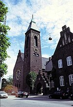
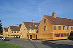
Grønningen is a street in central Copenhagen, Denmark, connecting Bredgade and the intersecting street Esplanaden to Oslo Plads in front of Østerport Station along the southwestern margin of the fortification Kastellet. It lends its name to the artists' cooperative Grønningen which was originally based in the street.
Excerpt from the Wikipedia article Grønningen, Copenhagen (License: CC BY-SA 3.0, Authors, Images).Grønningen, Copenhagen
Grønningen, Copenhagen Indre By
Geographical coordinates (GPS) Address Nearby Places Show on map
Geographical coordinates (GPS)
| Latitude | Longitude |
|---|---|
| N 55.6894 ° | E 12.5906 ° |
Address
Grønningen
Grønningen
1270 Copenhagen, Indre By
Capital Region of Denmark, Denmark
Open on Google Maps


