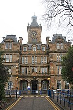
Craigleith, Edinburgh
Areas of EdinburghUse British English from January 2018

Craigleith (Scottish Gaelic: Creag Lìte) is an area of west Edinburgh, Scotland. Its name comes from various forms of Craig of Inverleith, or rock or hill of Inverleith. The area lies between Ravelston Dykes, to Crewe Toll and the Ferry Road, and Comely Bank on the east. Queensferry Road and Craigleith Road both pass through here. There are also a number of private schools in the area such as Stewart's Melville College and The Mary Erskine School. The Royal Victoria Hospital is off Craigleith Road while the Western General Hospital on Crewe Road was opened in 1868 as the Craigleith Hospital and Poorhouse.
Excerpt from the Wikipedia article Craigleith, Edinburgh (License: CC BY-SA 3.0, Authors, Images).Craigleith, Edinburgh
Carrington Road, City of Edinburgh Craigleith
Geographical coordinates (GPS) Address Nearby Places Show on map
Geographical coordinates (GPS)
| Latitude | Longitude |
|---|---|
| N 55.961666666667 ° | E -3.2286111111111 ° |
Address
Kimmerghame House
Carrington Road
EH4 1QR City of Edinburgh, Craigleith
Scotland, United Kingdom
Open on Google Maps


