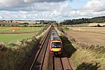
Gogar
Edinburgh Trams stopsNeolithic sites of EuropePages containing links to subscription-only contentStone Age sites in ScotlandUse British English from March 2017

Gogar is a predominantly rural area of Edinburgh, Scotland, located to the west of the city. It is not far from Gogarloch, Edinburgh Park and Maybury. The Fife Circle Line is to the north.
Excerpt from the Wikipedia article Gogar (License: CC BY-SA 3.0, Authors, Images).Gogar
Glasgow Road, City of Edinburgh
Geographical coordinates (GPS) Address Nearby Places Show on map
Geographical coordinates (GPS)
| Latitude | Longitude |
|---|---|
| N 55.935 ° | E -3.334 ° |
Address
RBS Gogarburn
Glasgow Road 175
EH12 9SB City of Edinburgh
Scotland, United Kingdom
Open on Google Maps


