place

Peebles' Corner Historic District

AC with 0 elementsHistoric districts in CincinnatiHistoric districts on the National Register of Historic Places in OhioNRHP infobox with nocatNational Register of Historic Places in Hamilton County, Ohio
Walnut Hills, Cincinnati
Peeble's Corner Historic District

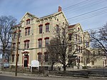
Peebles' Corner Historic District is a registered historic district surrounding the intersection of East McMillan Street and Gilbert Avenue in the neighborhood of Walnut Hills in Cincinnati, Ohio, United States. It was listed in the National Register of Historic Places on November 14, 1985. Beginning in 1883, the northeast corner was the site of the first branch of the Joseph R. Peebles' Sons Co. grocery store. The name Peebles' Corner caught on with the public when the store owners persuaded conductors to announce their store as a stop on Cincinnati streetcars. The intersection served (and still serves) as a key cross-town transit transfer point in the city. The intersection had previously been called Kay's Corner, after the W. L. Kay & Co. grocers on the southeast corner. Peebles' grocery store closed in 1931 at the height of the Great Depression.The Orpheum and Paramount theatres once stood at Peebles' Corner. Established in 1909, the Orpheum was the first playhouse built outside of the city center. The Opheum provided vaudeville entertainment then showed silent films. It was closed in 1952 and then later demolished. In the 1950s, businesses at Peebles' Corner declined further as white flight blighted this urban core. In the 1960s, blight was exacerbated by the riots of 1967. The Peebles' Corner Historic District was listed in the National Register of Historic Places on November 14, 1985. By 2009, several proposals had been aired for restoring Peebles' Corner. One vision of the Walnut Hills Area Council is for the city to acquire 10 to 15 buildings, and selectively tear down half. Resources would be concentrated on the buildings scheduled to become anchors in the district.

Excerpt from the Wikipedia article Peebles' Corner Historic District (License: CC BY-SA 3.0, Authors, Images).

Peebles' Corner Historic District
May Street, Cincinnati Walnut Hills

Geographical coordinates (GPS) Address Nearby Places
placeShow on map

Wikipedia: Peebles' Corner Historic DistrictContinue reading on Wikipedia

Geographical coordinates (GPS)

Latitude Longitude
N 39.125277777778 ° E -84.495277777778 °
placeShow on map

Address

May Street 2417
45206 Cincinnati, Walnut Hills
Ohio, United States
mapOpen on Google Maps

Peeble's Corner Historic District
Share experience

Nearby Places

Cummins School
Cummins School

The Cummins School is a historic former school building in Cincinnati, Ohio, United States. Built in 1871 in the neighborhood of Walnut Hills, it was later used as a model for the construction of other city school buildings.One of several Cincinnati school buildings designed by Samuel Hannaford, the Cummins School is a 3+1⁄2-story building. Built of brick with a stone foundation, it is topped with an asphalt roof and includes other elements of stone. Among its distinctive features are wrought iron stairways, ornamental wooden frames around the doors and windows, and wainscoting. The building's general floor plan features a central hallway, with classrooms lining both sides. The building as a whole was laid out in the shape of a double letter "E" to allow each room an increased amount of window space. Besides classrooms, the interior was equipped with rooms such as a library, a laboratory, and an office for the principal. One of the many forward-looking elements of its design was the heating system: although the building was originally heated with stoves, it was built to permit easy conversion to a steam-powered central heating system. More than thirty years after the building's construction, it was expanded by the addition of a small Neoclassical structure on its rear. The building as a whole was built in the Italianate style, similar to other Cincinnati schools built at the same time, such as the McKinley School on the city's east side.The Cummins School was eventually used by Cincinnati Public Schools as a model for later construction, due to its useful and economical floor plan. Its history paralleled that of the Eighteenth District School in the Camp Washington neighborhood; also a three-story Italianate brick building designed by Hannaford, it was erected in 1882 and expanded in 1908 and 1916. Hannaford's company continued to design buildings for Cincinnati Public Schools into the early twentieth century, their strong reputation having been established by buildings such as Cummins.In 1986, the Cummins School was listed on the National Register of Historic Places in recognition of its historically significant architecture. It joined dozens of other Hannaford designs in Hamilton County that had been listed on the National Register in 1980, including the Eighteenth District School. Five years later, the school was renovated at a cost of approximately $2,100,000. Today, it is used as an office building.

Gilbert Row
Gilbert Row

The Gilbert Row, as of 2005 often referred to as Emery Row, is a group of historic rowhouses in the southern part of the Walnut Hills neighborhood of Cincinnati, Ohio, United States. Composed of six individual small houses and a more substantial structure designed as a commercial building, the row was built by the real estate firm of Thomas Emery's Sons according to a design by the Steinkamp Brothers architectural firm. Built in 1889, the complex became a model for many residential complexes constructed by Thomas Emery's Sons during the 1890s, including multiple apartment-style properties in Walnut Hills. Buildings in the Gilbert Row are generally constructed on foundations of stone; their walls are built of brick or iron, and they feature other elements of brick and stone. Most buildings in the group do not feature iron: it is only present in the cast iron front of the building constructed as a store. Typical houses in the row feature porches with hip roofs, wooden posts with chamfered and reeded details, lattice-shaped valences, and ornamental brackets. Setting the complex apart from almost all other groups of rowhouses in the city is its general architectural style: it is a clear example of the Queen Anne style of architecture, which was rarely employed in the construction of rowhouses in Cincinnati.In May 1982, the Gilbert Row was listed on the National Register of Historic Places; it qualified for inclusion because of its well preserved and historically significant architecture, which was seen as important throughout the local area. Little more than a year later, a portion of southern Walnut Hills bounded by Morris, Gilbert, and Sinton Avenues was designated a historic district, the Gilbert-Sinton Historic District, and listed on the National Register, and the buildings of the Gilbert Row were among the district's contributing properties.The structure underwent a complete renovation between May 2005 and November 2006, transforming the building into 12 townhomes and 6 condominiums.

Gilbert–Sinton Historic District

The Gilbert–Sinton Historic District is an area in the southern portion of the Walnut Hills neighborhood of Cincinnati, Ohio, United States. A triangle measuring slightly more than 13 acres (5.3 ha) in area, the district's edges are generally Morris Street and Sinton Avenue (both small residential streets) and the substantially larger Gilbert Avenue, which is concurrently designated as U.S. Route 22 and State Route 3.Most of the district was created by a small group of real estate developers working in conjunction with each other. As a result, none of the present buildings were constructed before 1880, and little construction occurred after the turn of the 20th century. Additionally, the architecture is relatively homogenous: most of the buildings are large residences constructed as homes for the wealthy, and the architectural styles exhibited in the district (which is predominately Queen Anne and Shingle style) feature similar components and designs.In its early years, life in the present-day Gilbert–Sinton neighborhood was accompanied by plentiful amenities. When public transportation was initially established in the area, its first route ran along Sinton Avenue, and Cincinnati's first cable car line used Gilbert Avenue. Neighborhoods all along this pioneer cable car route expanded rapidly, and Gilbert–Sinton was no exception. Even today, the impact of these early public transportation routes is evident in the neighborhood. Residents did not need to travel for entertainment; besides being the district's southern boundary, Morris Street is the northern boundary of the large Eden Park.In 1983, the Gilbert–Sinton neighborhood was named a historic district and listed on the National Register of Historic Places. Eighty-seven of the district's ninety buildings were counted as contributing properties. Among these properties are the Gilbert Row along Gilbert Avenue and a pair of buildings known as Madam Fredin's Eden Park School and Neighboring Row House on Morris Street, which had already been listed on the National Register in 1982 and 1979 respectively.