Mooney Flat, California
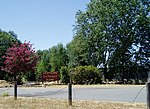
Mooney Flat was an important mining and transportation hub in western Nevada County, California, just east of the Yuba County line. It was situated on modern Mooney Flat Road, about 1 mile north of modern Highway 20, at an elevation of about 800 ft. Mooney Flat lies at the western end of the auriferous channel that runs down the San Juan Ridge. The channel disappears past French Corral and then reappears around Mooney Flat for a few miles, encompassing the communities, from east to west, of Mooney Flat, Sucker Flat, Smartsville and Timbuctoo, Smartsville was the principal town and still exists today. It is often hard to separate the history of Mooney Flat from the history of Smartsville. While the boundary drawn between Nevada County and Yuba County put Smartsville in Yuba County and Mooney Flat in Nevada County, in ensuing years, the Smartsville residents petitioned unsuccessfully to become part of Nevada County.
Excerpt from the Wikipedia article Mooney Flat, California (License: CC BY-SA 3.0, Authors).Mooney Flat, California
Mooney Flat Road,
Geographical coordinates (GPS) Address Nearby Places Show on map
Geographical coordinates (GPS)
| Latitude | Longitude |
|---|---|
| N 39.215555555556 ° | E -121.27444444444 ° |
Address
Mooney Flat Road 10814
95977
California, United States
Open on Google Maps


