place

June 2011 Christchurch earthquake

2010s in Christchurch2011 Christchurch earthquake2011 earthquakesJune 2011 events in New Zealand
13 June 2011 Christchurch earthquake damage

The June 2011 Christchurch earthquake was a shallow magnitude 6.0 Mw earthquake that occurred on 13 June 2011 at 14:20 NZST (02:20 UTC). It was centred at a depth of 7 km (4.3 mi), about 5 km (3 mi) south-east of Christchurch, which had previously been devastated by a magnitude 6.2 MW earthquake in February 2011. The June quake was preceded by a magnitude 5.9 ML tremor that struck the region at a slightly deeper 8.9 km (5.5 mi). The United States Geological Survey reported a magnitude of 6.0 Mw and a depth of 9 km (5.6 mi). The earthquake produced severe shaking, registering at VIII (Severe) on the Mercalli scale in and around Christchurch. It destroyed several structures and caused additional damage to many others which had been affected by previous earthquakes. The damaged tower of the historic Lyttelton Timeball Station collapsed before dismantling work could be completed. The earthquake downed phone lines and cut off power to 54,000 households. Restoration costs in Christchurch following the February earthquake were estimated to increase by NZ$6 billion (US$4.8 billion) because of the additional damage from this event. Forty-six people suffered injuries, two of which critical, and one elderly man died after being knocked unconscious.

Excerpt from the Wikipedia article June 2011 Christchurch earthquake (License: CC BY-SA 3.0, Authors, Images).

June 2011 Christchurch earthquake
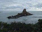
Te Ara Ihutai Christchurch Coastal Path, Linwood-Central-Heathcote Community Redcliffs

Geographical coordinates (GPS) Address Nearby Places
placeShow on map

Wikipedia: June 2011 Christchurch earthquakeContinue reading on Wikipedia

Geographical coordinates (GPS)

Latitude Longitude
N -43.56 ° E 172.74 °
placeShow on map

Address

Te Ara Ihutai Christchurch Coastal Path

Te Ara Ihutai Christchurch Coastal Path
8081 Linwood-Central-Heathcote Community, Redcliffs
Canterbury, New Zealand
mapOpen on Google Maps

13 June 2011 Christchurch earthquake damage
Share experience

Nearby Places

Clifton, Christchurch

Clifton is a hillside suburb above Sumner in Christchurch, New Zealand. Clifton is a volcanic spur extending from Tauhinukorokio / Mount Pleasant. Most of Clifton was originally purchased by Dr Alfred Barker, who had applied for a 50 acres (20 ha) land grant from the Christchurch land office. Barker sold his land in 1872. The lower part of Clifton was undeveloped until 1903, when it was subdivided into 93 sections and put up for auction, as far up the hill as Tuawera Terrace, which was originally known as Victoria Terrace. The land further up the hill was subdivided in 1908. A lower side spur, originally known as Lower Clifton, was bought in 1901 by Samuel Hurst Seager. Seager landscaped and divided the section into 12 plots and it was sold under the name The Spur in 1914. It has been known as the Spur since. This area is the main residential hill area above Sumner.The ridge that Clifton lies upon, descends from Tauhinukorokio / Mount Pleasant to end in a coastal cliff at the western end of Sumner beach. The cliff overhangs the road between Sumner and Moncks Bay that has been built along the beach. This area by the beach is now known as Peacocks Gallop because John Thomas Peacock would gallop his horse when riding along this section of road on account of his fear of being hit by falling rocks. Earthquakes in 2011 and later in 2016 caused the cliff edge to collapse and recede so much that several clifftop houses were undermined and severely damaged, or left perched precariously on the cliff edge. Shipping containers were stacked two-high on the main road below to protect it from further rockfalls and these subsequently became an impromptu roadside art gallery.

Richmond Hill, New Zealand

Richmond Hill is a hillside suburb above Sumner in Christchurch, New Zealand. Richmond Hill is a volcanic spur extending from Tauhinukorokio / Mount Pleasant. The first European owner was Edward Dobson, who had a cottage in Nayland Street and whose 50 acres (20 ha) ran up the hill. Dobson kept 2 acres (0.81 ha) around his house and sold the remainder of his land to George Day. Upon Day's death, the land passed to his daughter, who sold it to the Morton brothers (Arthur and R. M. D.), and who in turn sold it to George Humphreys. The latter subdivided the land and had a road up the hill built by 1909. Walter de Thier managed Humphreys' farm on the hill and his favourite song was "The Lass of Richmond Hill", and with Humphreys' consent, the property was called Richmond Hill.Humphreys was a leading businessman who lived at Daresbury in Fendalton. He was also a member of the Christchurch Golf Club and took pity of a group of men who regularly met in Sumner on an empty section for an improvised game of golf using hockey sticks, tennis balls, and tin cans sank into the ground as holes. He offered them 40 acres (16 ha) of his undulating land, on which the 12-hole Richmond Hill Golf Course opened in April 1910.Due to the steepness of the road up from Nayland Street, the subdivision was slow to develop. There were just ten houses on Richmond Hill by 1930, and activity only picked up after the end of World War II. One of the early residents included the architect Cecil Wood. The golf course closed in December 1997 and some of the land was further subdivided.