Craigkelly transmitting station

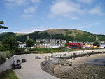
The Craigkelly transmitting station is a broadcasting and telecommunications facility located at Craigkelly (grid reference NT233872) north of the Firth of Forth above the town of Burntisland in Fife, Scotland. It has a 125-metre tall free-standing lattice tower reassembled after being moved from its original location at Emley Moor, West Yorkshire, where it was used to broadcast the 405-line ITV service between 1956 and 1966.The station came into service in 1968 to improve coverage of BBC2 to the Edinburgh area, which has a number of hills blocking good reception from Black Hill. In September 1971 it also started broadcasting BBC1 and Scottish Television on 625 lines in colour and though considered a 'main' station, it actually rebroadcast the signal from the Black Hill transmitting station, like a relay. In March 1983 Channel 4 was added (five months after programmes began), however Channel 5 was available at its launch on 30 March 1997.Its tower now also carries antennas for many broadcasting and private radio organisations. Craigkelly is part of the STV Central TV region. The transmitter was originally an A group but has become a K group (or wideband) with the advent of Channel 5 and Digital. Craigkelly is one of the few main transmitters which did not return to its original group at Digital Switchover (DSO). However, when Craigkelly went through its 700 MHz clearance in October 2018 all of the main 6 muxes returned to the A group, the only two outside being muxes 7 and 8 (see Craigkelly's graph) which were to be switched off between 2020 and 2022. The tower can be clearly seen from many parts of Edinburgh across the Firth of Forth on its prominent position atop the hill known as The Binn.
Excerpt from the Wikipedia article Craigkelly transmitting station (License: CC BY-SA 3.0, Authors, Images).Craigkelly transmitting station
Heubesstraße, Düsseldorf Benrath (Stadtbezirk 9)
Geographical coordinates (GPS) Address Nearby Places Show on map
Geographical coordinates (GPS)
| Latitude | Longitude |
|---|---|
| N 56.071944 ° | E -3.233194 ° |
Address
Heubesstraße 23
40597 Düsseldorf, Benrath (Stadtbezirk 9)
Nordrhein-Westfalen, Deutschland
Open on Google Maps


