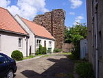
Prestonpans
Mining communities in ScotlandPopulated coastal places in ScotlandPrestonpansTowns in East LothianUse British English from September 2011

Prestonpans ( Scottish Gaelic: Baile an t-Sagairt, Scots: The Pans) is a small mining town, situated approximately eight miles east of Edinburgh, Scotland, in the council area of East Lothian. The population as of 2020 is 10,460. It is near the site of the 1745 Battle of Prestonpans (first called the Battle of Gladsmuir, then renamed the Battle of Tranent, and later still renamed the Battle of Prestonpans – although evidence shows the battle occurred a few miles outside of town). Prestonpans is "Scotland's Mural Town", with many murals depicting local history.
Excerpt from the Wikipedia article Prestonpans (License: CC BY-SA 3.0, Authors, Images).Prestonpans
Jacobite Way,
Geographical coordinates (GPS) Address Nearby Places Show on map
Geographical coordinates (GPS)
| Latitude | Longitude |
|---|---|
| N 55.9597 ° | E -2.961 ° |
Address
Jacobite Way
Jacobite Way
EH32 9JE , Cockenzie
Scotland, United Kingdom
Open on Google Maps


