place

St Austell River

Rivers of Cornwall
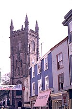
St Austell River and Cycle Path geograph.org.uk 43637

The St Austell River (Cornish: Dowr an Wynyk, meaning the little white river) properly known as the River Vinnick, but historically called The White River, is a 12 kilometres (7.5 mi) long river located in south Cornwall, England, United Kingdom. 50.337°N 4.793°W / 50.337; -4.793. The river has also been known as the "red river" due to tin streaming and mining activity upstream. The river drains the central southern section of the St Austell Moorland, the second largest granite mass in Cornwall, an upland formed in the Variscan orogeny, to the north of St Austell. The highest natural point of the moorland is Hensbarrow Beacon at 312 metres (1,024 ft); however modern china clay mining waste tips now rise above it. The name White River has been adopted locally because waste water from china clay quarrying and refining practices was emptied into the river giving it a white colour.The local term White River has given its name to the St Austell Town Centre Redevelopment Scheme, which is now called White River Place.

Excerpt from the Wikipedia article St Austell River (License: CC BY-SA 3.0, Authors, Images).

St Austell River
Aylmer Place,

Geographical coordinates (GPS) Address Nearby Places
placeShow on map

Wikipedia: St Austell RiverContinue reading on Wikipedia

Geographical coordinates (GPS)

Latitude Longitude
N 50.337 ° E -4.793 °
placeShow on map

Address

White River Place

Aylmer Place
PL25 5LJ
England, United Kingdom
mapOpen on Google Maps

St Austell River and Cycle Path geograph.org.uk 43637
Share experience

Nearby Places

Radio St Austell Bay

CHAOS Radio (formerly known as Radio St Austell Bay and RSAB, often incorrectly called St Austell Bay Radio) is a non-profit, community radio station. The radio station is funded by a combination of grants from the National Lottery and the Arts Council, alongside a small amount of commercial advertising and sponsorship. Partners include the Eden Project, the Lost Gardens of Heligan, and the Cornish Guardian. All of the partners present shows on the station, alongside the regular DJs. RSAB ran a Short Term RSL in February 2006 and presented their community programmes for 2 weeks. The response to the station suggested a desire for such a full-time service. RSAB's signal from Tregorrick Park (90 metres AMSL) could be picked up as far away as Plymouth whilst operating within OFCOM regulations. In February 2007 OFCOM granted Radio St Austell Bay a community radio station licence. The station started broadcasting on 28 January 2008, on 105.6FM and online. RSAB broadcasts from a transmitter at Tregorrick Park (Home of St Austell RFC), which is in St Austell. As its name suggests, Radio St Austell Bay covers the whole area from Tywardreath in the east to Sticker in the west, without focusing solely on St Austell town itself. St Austell is one of the largest settlements and the St Austell Bay area (population 34,700) is the second largest conurbation in Cornwall, after the Camborne-Pool-Redruth area (population 55,400).Radio St Austell Bay also promotes and broadcasts live music events, in the bar adjacent to the studio at Tregorrick Park. Other live broadcasts have included The Eden Project's Arts Café, Tanya's Courage Sing For Courage 2008, and a 2-day broadcast from the offices of the Cornish Guardian in St Austell, for publicity. Starting in 2014 Radyo an Gernewegva, an hour-long magazine programme in the Cornish language, is being broadcast every Sunday at midday. In 2023 RSAB agreed a new partnership with a local group and relaunched as CHAOS Radio on 26th June 2023. The station will continue to offer a wide range of programming, featuring “Feel Good Music”, national and local news bulletins, talk shows, community events and live broadcasts on location. Also with the rebrand the station moved to a new space from the original Tregorrick Park Studio.