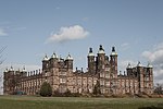
Ardmillan
Areas of EdinburghUse British English from August 2017

Ardmillan (Scottish Gaelic: Aird a' Mhaolain, IPA:[ˈaːɾʲtʲˈaˈvɯːɫ̪ɪn]) is a mainly residential suburb of Edinburgh, Scotland. The area developed during the mid to late Victorian era as Edinburgh expanded and many of the present tenement flats and houses date from this era. The area is bisected by the A70 road and its north-west edge is marked by the Shotts railway line. The area has several pubs, small shops, churches and a cemetery.
Excerpt from the Wikipedia article Ardmillan (License: CC BY-SA 3.0, Authors, Images).Ardmillan
Angle Park Terrace, City of Edinburgh Dalry
Geographical coordinates (GPS) Address Nearby Places Show on map
Geographical coordinates (GPS)
| Latitude | Longitude |
|---|---|
| N 55.938 ° | E -3.2258333333333 ° |
Address
The Caley Sample Room
Angle Park Terrace 42-58
EH11 2JR City of Edinburgh, Dalry
Scotland, United Kingdom
Open on Google Maps


