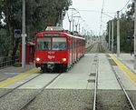
Otay Mesa West, San Diego
Neighborhoods in San DiegoSouth Bay (San Diego County)
Otay Mesa West is a residential neighborhood in the southern section of San Diego. It borders Interstate 805 to the east, Interstate 5 to the west, and California State Route 905 to the south. It neighbors Ocean View Hills to the east, Nestor and Palm City to the west and Chula Vista to the north. The northern boundary of Otay Mesa West roughly coincides with the Otay River. Just north of the Otay River the community of Otay resides within the city of Chula Vista. Major thoroughfares include Palm Avenue, Coronado Avenue, Picador Boulevard, Del Sol Boulevard, Beyer Boulevard, and Beyer Way.
Excerpt from the Wikipedia article Otay Mesa West, San Diego (License: CC BY-SA 3.0, Authors).Otay Mesa West, San Diego
Picador Boulevard, San Diego
Geographical coordinates (GPS) Address Nearby Places Show on map
Geographical coordinates (GPS)
| Latitude | Longitude |
|---|---|
| N 32.580555555556 ° | E -117.06027777778 ° |
Address
Picador Boulevard 796
92154 San Diego
California, United States
Open on Google Maps


