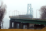
Johnstown District, Upper Canada
1798 establishments in Upper Canada1849 disestablishments in CanadaDistricts of Upper CanadaHistory of Leeds and Grenville United Counties

The Johnstown District was a historic district in Upper Canada which existed until 1849.
Excerpt from the Wikipedia article Johnstown District, Upper Canada (License: CC BY-SA 3.0, Authors, Images).Johnstown District, Upper Canada
Mary Street, Edwardsburgh/Cardinal
Geographical coordinates (GPS) Address Nearby Places Show on map
Geographical coordinates (GPS)
| Latitude | Longitude |
|---|---|
| N 44.75 ° | E -75.47 ° |
Address
Mary Street 42
K0E 1T1 Edwardsburgh/Cardinal
Ontario, Canada
Open on Google Maps


