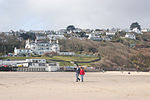
Trencrom Hill
Archaeological sites in CornwallHill forts in CornwallNational Trust properties in CornwallNeolithicPenwith ... and 2 more
Stone Age sites in CornwallUse British English from January 2016

Trencrom Hill (or Trecrobben) is a prominent hill fort, owned by the National Trust, near Lelant, Cornwall. It is crowned by an univallate Neolithic tor enclosure and was re-used as a hillfort in the Iron Age. Cairns or hut circles can be seen in the level area enclosed by the stone and earth banks. The hill overlooks the Hayle Estuary and river, and Mount's Bay and St Michael's Mount can be seen to the south. The hill was recorded as Torcrobm in 1758 which is derived from Cornish "torr crobm", i.e. 'hunched bulge'.Trink lies one kilometre to the north west.
Excerpt from the Wikipedia article Trencrom Hill (License: CC BY-SA 3.0, Authors, Images).Trencrom Hill
St Michael's Way,
Geographical coordinates (GPS) Address External links Nearby Places Show on map
Geographical coordinates (GPS)
| Latitude | Longitude |
|---|---|
| N 50.1736 ° | E -5.4776 ° |
Address
Trencrom Hill Fort
St Michael's Way
TR27 6NJ , Ludgvan
England, United Kingdom
Open on Google Maps


