place

Sachs Covered Bridge

1854 establishments in PennsylvaniaBridges completed in 1854Covered bridges in Adams County, PennsylvaniaCovered bridges on the National Register of Historic Places in PennsylvaniaLattice truss bridges in the United States
National Register of Historic Places in Adams County, PennsylvaniaRoad bridges on the National Register of Historic Places in PennsylvaniaWooden bridges in Pennsylvania
Sachs Bridge Gettysburg

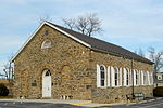
The Sachs Covered Bridge , also known as Sauck's Covered Bridge and Waterworks Covered Bridge, is a 100-foot (30 m), Town truss covered bridge over Marsh Creek between Cumberland and Freedom Townships, Adams County in the U.S. state of Pennsylvania. The bridge was also known as the Sauches Covered Bridge at the time of the Battle of Gettysburg. It was listed on the National Register of Historic Places in 1980. During the American Civil War, both the Union and Confederate Armies used the bridge in the Battle of Gettysburg and its aftermath. It is reportedly known to be severely haunted as a result.

Excerpt from the Wikipedia article Sachs Covered Bridge (License: CC BY-SA 3.0, Authors, Images).

Sachs Covered Bridge
Waterworks Road,

Geographical coordinates (GPS) Address Nearby Places
placeShow on map

Wikipedia: Sachs Covered BridgeContinue reading on Wikipedia

Geographical coordinates (GPS)

Latitude Longitude
N 39.797361111111 ° E -77.276111111111 °
placeShow on map

Address

Sachs Covered Bridge

Waterworks Road
17325
Pennsylvania, United States
mapOpen on Google Maps

Sachs Bridge Gettysburg
Share experience

Nearby Places

Rose Woods
Rose Woods

Rose Woods is a Gettysburg Battlefield forested area that is an American Civil War site of the battle's Hood's Assault, McLaws' Assault, and McCandless' Advance. "Scene of the first line of Union defenses" on the Battle of Gettysburg, Second Day; the 1st Texas Infantry and 3rd Arkansas Infantry Regiments attacked Ward's 2nd Brigade line in the woods. The last combat on the Battle of Gettysburg, Third Day, was "in the early evening. Colonel William McCandless's brigade of Pennsylvania Reserves advanced across the Wheatfield into Rose's Woods where they managed to inflict heavy losses on the 15th Georgia" which had failed to retreat to Warfield Ridge after Longstreet's Assault. Two days later Timothy H. O'Sullivan photographed corpses moved for burial to the edge of Rose Woods and which were subsequently reinterred in cemeteries. De Trobriand Avenue and other Military Park roads provide access to the woods' battlefield monuments, and the woods' railbed for the 1894-1916 Gettysburg Electric Railway is a historic district contributing structure that is now a rail trail. Monuments in the woods include the 1890 Sixty-fourth New York Regiment Monument, and Wheat-field Park in "Wible's Grove" was a commemorative era trolley park. The trolley's overhead power line broke at Wible's Woods in 1900, and the woods had the postbellum "William Wible's Quarry" for Gettysburg Granite (cf. Rosensteel's Quarry north of the Round Top Museum). In 2004, the archeological remains of the former trolley bridge in Rose Woods were named a historic district contributing structure.