Sankt Annæ Plads

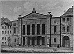
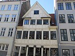
Sankt Annæ Plads (English: St. Ann's Square) is a public square which marks the border between the Nyhavn area and Frederiksstaden neighborhoods of central Copenhagen, Denmark. It is a long narrow rectangle which extends inland from the waterfront, at a point just north of the Royal Danish Playhouse at the base of the Kvæsthus Pier, now known as Ofelia Plads, until it meets Bredgade. A major renovation of the square was completed in 2016.The Garrison Church is located on the south side of the square. Amaliegade, one of the two axes on which Frederiksstaden is centered, extends from the square. The square has a central garden complex along its length with an equestrian statue of Christian X of Denmark facing Bredgade.
Excerpt from the Wikipedia article Sankt Annæ Plads (License: CC BY-SA 3.0, Authors, Images).Sankt Annæ Plads
Sankt Annæ Plads, Copenhagen Frederiksstaden
Geographical coordinates (GPS) Address Nearby Places Show on map
Geographical coordinates (GPS)
| Latitude | Longitude |
|---|---|
| N 55.6815 ° | E 12.5915 ° |
Address
Franklin D. Roosevelt
Sankt Annæ Plads
1250 Copenhagen, Frederiksstaden
Capital Region of Denmark, Denmark
Open on Google Maps


