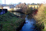
Gorbals
The Gorbals is an area in the city of Glasgow, Scotland, on the south bank of the River Clyde. By the late 19th century, it had become densely populated; rural migrants and immigrants were attracted by the new industries and employment opportunities of Glasgow. At its peak, during the 1930s, the wider Gorbals district (which includes the directly adjoined localities of Laurieston and Hutchesontown) had swollen in population to an estimated 90,000 residents. Along with its relatively small size, this gave the area a very high population density of around 40,000/km². Redevelopment after WWII has taken many turns, and the area's population is substantially smaller today. The Gorbals was also home to 16 high rise flat blocks, now only 6 of them are standing in 2023 and 2 of them are set to come down in the next couple of years.
Excerpt from the Wikipedia article Gorbals (License: CC BY-SA 3.0, Authors).Gorbals
Sandiefield Road, Glasgow Gorbals
Geographical coordinates (GPS) Address Website Nearby Places Show on map
Geographical coordinates (GPS)
| Latitude | Longitude |
|---|---|
| N 55.84861 ° | E -4.25222 ° |
Address
New Gorbals Health and Care Centre
Sandiefield Road 2
G5 9AB Glasgow, Gorbals
Scotland, United Kingdom
Open on Google Maps


