place

Amherstburg

1796 establishments in CanadaAmherstburg, OntarioLower-tier municipalities in OntarioOntario populated places on the Detroit RiverPopulated places on Lake Erie in Canada
Populated places on the Underground RailroadTowns in OntarioUse mdy dates from May 2023
Amherstberg ontario sandwich street

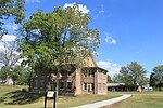
Amherstburg is a town near the mouth of the Detroit River in Essex County, Ontario, Canada. In 1796, Fort Malden was established here, stimulating growth in the settlement. The fort has been designated as a National Historic Site. The town is approximately 25 kilometres (16 mi) south of the U.S. city of Detroit, Michigan, facing Wyandotte, Grosse Ile Township, Brownstown Charter Township, Trenton, and Gibraltar, Michigan. It is part of the Windsor census metropolitan area.

Excerpt from the Wikipedia article Amherstburg (License: CC BY-SA 3.0, Authors, Images).

Amherstburg
Simcoe Street,

Geographical coordinates (GPS) Address Nearby Places
placeShow on map

Wikipedia: AmherstburgContinue reading on Wikipedia

Geographical coordinates (GPS)

Latitude Longitude
N 42.1 ° E -83.083333333333 °
placeShow on map

Address

Simcoe Street 698
N9V 3Y9
Ontario, Canada
mapOpen on Google Maps

Amherstberg ontario sandwich street
Share experience

Nearby Places

Fort Amherstburg
Fort Amherstburg

Fort Amherstburg was built by the Royal Canadian Volunteers at the mouth of the Detroit River to replace Fort Detroit, which Britain was required to cede to the United States of America in 1796 as a result of the Jay Treaty. Built in the years before the War of 1812, Fort Amherstburg included "King's Navy Yard" for shipbuilding on the upper Great Lakes (Lakes Erie, Huron, and Superior). The War of 1812 began and escalated quickly with US General William Hull invading Canada in July 1812. Soldiers from the fort repelled the Americans at River Canard. After General Hull retreated back to Fort Detroit, British General Isaac Brock and the Shawnee Chief Tecumseh met at Fort Amherstburg to plan the attack of Fort Detroit in the British Indian Department building located outside of the fort grounds. After losing the Battle of Lake Erie (including the flagship HMS Detroit, which was built at the nearby Navy Yard Park), the British/Canadians destroyed the fort and retreated as most of the cannons normally placed in the bastions were put onto the ships to be used for the engagement on Lake Erie and subsequently were lost. The Americans built a new, smaller fort on the same site with a reduced perimeter. The north-west bastion and connected wall still remain today . After the end of the war, the British/Canadians reclaimed (what is now) Southern Ontario and Fort Malden. After the War of 1812, the British let the fort fall into disrepair until threats of rebellion grew in Upper Canada. The fort was repaired to full military use and was garrisoned with men from the 34th Regiment of Foot (made famous for their routing the French 34th regiment during the Napoleonic wars). After the 1837 rebellion was ended, the Fort again was not necessary as a military installation. It was changed from a military institution to a psychiatric institution. Its employees resided in the smallest barracks building, and the other two large barracks housed inmates sorted by gender. Trees were planted on and around the fort property to provide much-needed shade, which had not been wanted by the military as it would have obscured their view of an attacking force. After some time, the psychiatric institution moved to St. Catharines, Ontario, where it still exists today. After that second use for the grounds ended, the fort property was used as a woodmill until the property was sold off as private residences. The two large barracks buildings are no longer on the grounds. One was moved into the town of Amherstburg where it burned down during the 1920s while being used as a stable. The other barracks building technically still exists today. It has been moved from the fort grounds, divided up into three and sold as individual residences. They maintain the same shape as they had had as barracks, and at least one of the houses was found to have its original walls still intact. Fort Amherstburg still continues today in a military tradition and is a historic site (known as Fort Malden) that is frequently visited by tourists from around the world. Every Canada Day, an 1812 6-pounder field cannon is fired before a large display of fireworks is commenced. The Fort is garrisoned with summer staff who wear the same pattern of uniform and ladies who wear clothing styles of the early 19th century. Visitors can see what fort life was like in the early 19th century through cooking demonstrations and musket firing demonstrations. The biggest event at Fort Malden would be on the Canadian Civic Holiday weekend where re-enactors of time periods ranging from Ancient Rome to World War II gather and perform combat demonstrations and have a full encampment.

Fort Malden
Fort Malden

Fort Malden, formally known as Fort Amherstburg, is a defence fortification located in Amherstburg, Ontario. It was built in 1795 by Great Britain in order to ensure the security of British North America against any potential threat of American invasion. Throughout its history, it is most known for its military application during the War of 1812 as Sir Isaac Brock and Tecumseh met here to plan the Siege of Detroit. It was the British stronghold during the war and is now a National Historic Site of Canada. The fort also had an important role in securing Upper Canada's border with Detroit during the Upper Canada Rebellion.Fort Malden also has rich and diverse history aside from its military applications. For example, it was the setting for the British Pensioner Scheme and would later become an Ontario Provincial Asylum in 1859. After the asylum was closed, Fort Malden was surveyed and privatized until the mid-nineteenth century. The historic designation of the fort came after several decades of local residents advocating for the preservation of the fort to the federal government. Officially recognized in 1921, the complex of Fort Malden as it is seen today was brought together in 1946 with the purchase of the Hough House. Today, the fort remains open and accessible to the public under the supervision of Parks Canada. Visitors are able to see for themselves a wide array of Fort Malden's history as all of the buildings on the complex represent different time periods within that history. For example, an 1819 Brick Barrack restored in the style of one in 1839 is found directly across from the Hough House that represents the fort's history as an asylum, a lumber mill, and a private residence.

Powder House Island
Powder House Island

Powder House Island (also known as Dynamite Island) is an artificial island on the lower Detroit River in southeast Michigan, directly adjacent to the Canada–United States border. It was constructed in the late 1880s by the Dunbar & Sullivan Company to store explosives during their dredging of the Livingstone Channel. It was constructed in a successful attempt to circumvent an 1880 court order forbidding the company to store explosives on nearby Fox Island. Powder House Island was the location of dynamite storage sheds, as well as a dynamite factory and several ice houses. During this time, it was the site of a series of accidents, including fires in 1895 and 1919 (which both burned the island "to the water's edge"). Twenty short tons (18,000 kg) of the island's dynamite exploded in 1906 after two men "had been shooting with a revolver" near it; while there were no deaths (and only minor injuries to the two men), windows were shattered 3 mi (4.8 km) away and the explosion was clearly audible from 85 mi (137 km) away. After the completion of the Livingstone Channel in 1912, the island continued to be used for storing explosives, including during later projects to deepen the channel in the 1930s. By the 1980s it was completely unused, and by 2015 the island was owned by the Michigan Department of Natural Resources, managed by its Wildlife Division as part of the Pointe Mouillee State Game Area, and accessible to the public for hunting.