place

Tsawwassen Lands

Delta, British ColumbiaFirst Nations stubsIndian reserves in the Lower MainlandSouth Coast of British Columbia geography stubsUse Canadian English from January 2023

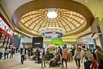
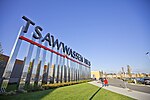
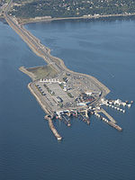
The Tsawwassen Lands is the sole reserve of land that the Tsawwassen First Nation has authority over in British Columbia, Canada, and is located adjacent to the causeway of the Tsawwassen ferry terminal. To the south is the Canada–United States border and on the north is Canoe Pass, an arm of the Fraser River. The First Nation operates a park-and-ride for ferry customers, and also has a residential development housing non-natives called Tsatsu Shores just south of the causeway. The Tsawwassen Lands, which were extinguished as an Indian Reserve and are now fee-simple land holdings since the Tsawwassen Treaty, effective April 3, 2009, are 662 hectares (1,640 acres) in area.The Tsawwassen Mills mall is located within this area.

Excerpt from the Wikipedia article Tsawwassen Lands (License: CC BY-SA 3.0, Authors).

Tsawwassen Lands
PAQES Lane,

Geographical coordinates (GPS) Address Nearby Places
placeShow on map

Wikipedia: Tsawwassen LandsContinue reading on Wikipedia

Geographical coordinates (GPS)

Latitude Longitude
N 49.034722222222 ° E -123.09583333333 °
placeShow on map

Address

PAQES Lane

PAQES Lane
V4M 4G2
British Columbia, Canada
mapOpen on Google Maps

Share experience

Nearby Places

Tsawwassen
Tsawwassen

Tsawwassen (English: tə-WAH-sən) is a suburban, mostly residential community on a peninsula in the southwestern corner of the City of Delta in British Columbia, Canada. It provides the only road access to the American territory on the southern tip of the peninsula, the community of Point Roberts, Washington, via 56th Street. It is also the location of Tsawwassen Ferry Terminal, part of the BC Ferries, built in 1959 to provide foot-passenger and motor vehicle access from the Lower Mainland to the southern part of Vancouver Island and the southern Gulf Islands. Because Tsawwassen touches a shallow bank (Roberts Bank), the ferry terminal is built at the southwestern end of a 3 km (1.9 mi) causeway (part of Highway 17) that juts into the Strait of Georgia. Boundary Bay Airport, a major training hub for local and international pilots which also provides local airplane and helicopter service, is ten minutes away. The Roberts Bank Superport is also nearby. To the northwest of the community are the lands of Tsawwassen First Nation ("TFN"), a people of Coast Salish ancestry who have used this land since at least 200 B.C. Having been "stripped of their lands, rights and resources" by European colonizers throughout the 19th century, and in accordance with a 2009 treaty with British Columbia, their territory now consists of approximately 724 ha (1,790 acres) of treaty settlement land, bounded by the Strait of Georgia on the west, the 2600 block to the north, the 4800 block to the east, and the 1200 block to the south. While also part of TFN lands, the 92-lot residential subdivision of Stahaken was leased for use by the (then) Tsawwassen Indian Reserve to Staheken Developments Ltd. in 1989 for a 99-year term. It was then developed in a partnership between Stahaken Development Ltd. and the Municipality of Delta. As such it is commonly thought of and serviced in the same manner as other subdivisions in the community of Tsawwassen. Stahaken residents are represented by the Stahaken Homeowners Association.