Barnton, Edinburgh
Areas of EdinburghEdinburgh geography stubsUse British English from April 2017

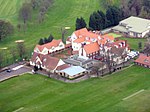
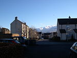
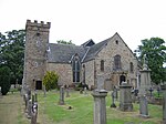
Barnton (Scottish Gaelic: Baile an t-Sabhail) is a suburb of Edinburgh, Scotland, in the north-west of the city, between Cramond and Corstorphine Hill and west of Davidsons Mains. Part of the area was traditionally known as "Cramond Muir" in reference to Cramond to the north.
Excerpt from the Wikipedia article Barnton, Edinburgh (License: CC BY-SA 3.0, Authors, Images).Barnton, Edinburgh
Whitehouse Road, City of Edinburgh Cammo
Geographical coordinates (GPS) Address Nearby Places Show on map
Geographical coordinates (GPS)
| Latitude | Longitude |
|---|---|
| N 55.962744444444 ° | E -3.3074138888889 ° |
Address
Whitehouse Road 192
EH4 6BX City of Edinburgh, Cammo
Scotland, United Kingdom
Open on Google Maps


