Big Sable River
Lower Peninsula, Michigan geography stubsMichigan river stubsRivers of Mason County, MichiganRivers of MichiganTributaries of Lake Michigan

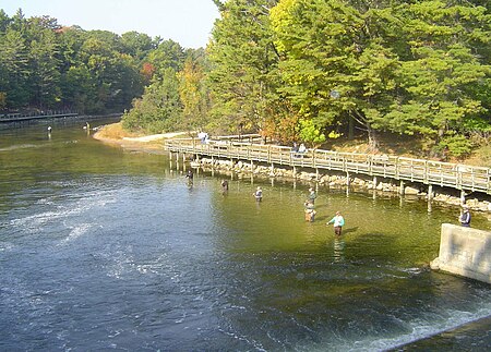
The Big Sable River is a 52-mile-long (84 km) river in Michigan in the United States. It originates in Lake County in the chain of lakes known as Sauble Lakes and flows across Lake and Mason counties. It is dammed to form Hamlin Lake, and below the dam continues through Ludington State Park to empty into Lake Michigan. It is not navigable for the most part, but the section between Hamlin Lake and Lake Michigan is popular for tubing. It is considered an excellent river for fishing. It appears on maps as both "Big Sable" and "Big Sauble".
Excerpt from the Wikipedia article Big Sable River (License: CC BY-SA 3.0, Authors, Images).Big Sable River
State Highway 116, Hamlin Township
Geographical coordinates (GPS) Address Nearby Places Show on map
Geographical coordinates (GPS)
| Latitude | Longitude |
|---|---|
| N 44.03028 ° | E -86.50703 ° |
Address
State Highway 116
State Highway 116
Hamlin Township
Michigan, United States
Open on Google Maps


