Bridgeport, Nevada County, California
1849 establishments in CaliforniaCalifornia ghost town stubsFormer populated places in CaliforniaFormer settlements in Nevada County, CaliforniaMining communities of the California Gold Rush ... and 3 more
Nevada County, California geography stubsPopulated places established in 1849Yuba River

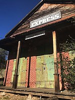
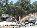
Bridgeport (also: Nyes Landing and Nye's Crossing) is a former settlement on the Yuba River in Nevada County, California, 2 mi (3.2 km) from the town of French Corral. Its elevation is 567 ft (173 m) above sea level.It is notable for the Bridgeport Covered Bridge, a national and state historic landmark, used as a pedestrian crossing over the South Yuba River. The South Yuba River State Park is adjacent.
Excerpt from the Wikipedia article Bridgeport, Nevada County, California (License: CC BY-SA 3.0, Authors, Images).Bridgeport, Nevada County, California
Pleasant Valley Road,
Geographical coordinates (GPS) Address Nearby Places Show on map
Geographical coordinates (GPS)
| Latitude | Longitude |
|---|---|
| N 39.291666666667 ° | E -121.19361111111 ° |
Address
Pleasant Valley Road 17671
95946
California, United States
Open on Google Maps


