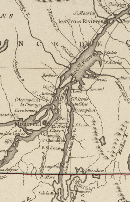
Siege of Fort St. Jean

The siege of Fort St. Jean (September 17 – November 3, 1775 French: Siège du Fort Saint-Jean) was conducted by American Brigadier General Richard Montgomery on the town and fort of Saint-Jean, also called St. John, St. Johns, or St. John's, in the British province of Quebec during the American Revolutionary War. The siege lasted from September 17 to November 3, 1775. After several false starts in early September, the Continental Army established a siege around Fort St. Jean. Beset by illness, bad weather, and logistical problems, they established mortar batteries that were able to penetrate into the interior of the fort, but the defenders, who were well-supplied with munitions, but not food and other supplies, persisted in their defence, believing the siege would be broken by forces from Montreal under General Guy Carleton. On October 18, the nearby Fort Chambly fell, and on October 30, an attempt at relief by Carleton was thwarted. When word of this made its way to St. Jean's defenders, combined with a new battery opening fire on the fort, the fort's defenders capitulated, surrendering on November 3. The fall of Fort St. Jean opened the way for the American army to march on Montreal, which fell without battle on November 13. General Carleton escaped from Montreal, and made his way to Quebec City to prepare its defences against an anticipated attack.
Excerpt from the Wikipedia article Siege of Fort St. Jean (License: CC BY-SA 3.0, Authors, Images).Siege of Fort St. Jean
Rue des Remparts, Saint-Jean-sur-Richelieu
Geographical coordinates (GPS) Address Nearby Places Show on map
Geographical coordinates (GPS)
| Latitude | Longitude |
|---|---|
| N 45.298888888889 ° | E -73.251666666667 ° |
Address
P5
Rue des Remparts
J3B 2Y5 Saint-Jean-sur-Richelieu (Saiint-Jean)
Quebec, Canada
Open on Google Maps


