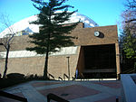
Bergen-Lafayette, Jersey City
Bergen-Lafayette is a section of Jersey City, New Jersey.As its name implies, Bergen-Lafayette is made of different neighborhoods. It lies west-southwest of Downtown and Liberty State Park. Its less-defined other borders overlap those of Greenville at Hudson-Bergen Light Rail to the south, Lincoln Park/West Bergen to the west, and Montgomery Street at McGinley Square to the north. The name Bergen, used throughout Hudson County, is taken from the original Bergen, New Netherland settlement at Bergen Square. The district can correspond to the former Bergen City, which existed from 1855 to 1870 and was originally incorporated as a town by an Act of the New Jersey Legislature on March 24, 1855, from portions of Bergen Township. In 1862, it did a reverse takeover, absorbing the remaining portions Bergen Township. On April 14, 1863, portions of the town were taken to form Greenville Township. Bergen was reincorporated as a city on March 11, 1868. On May 2, 1870, both Bergen City and Hudson City elected to merge with Jersey City.
Excerpt from the Wikipedia article Bergen-Lafayette, Jersey City (License: CC BY-SA 3.0, Authors).Bergen-Lafayette, Jersey City
Fairmount Avenue, Jersey City
Geographical coordinates (GPS) Address Nearby Places Show on map
Geographical coordinates (GPS)
| Latitude | Longitude |
|---|---|
| N 40.72567 ° | E -74.07138 ° |
Address
Fairmount Avenue 340
07306 Jersey City
New Jersey, United States
Open on Google Maps


