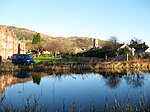
Kilpatrick Hills

The Kilpatrick Hills are a range of hills in central Scotland, stretching from Dumbarton in the west to Strathblane in the east. Strathblane divides the Kilpatricks from the Campsie Fells to the east, while to the north is part of the Loch Lomond and the Trossachs National Park. To west and south the hills are fringed by the settlements of Balloch, Dumbarton, Milton, Bowling, Old Kilpatrick, Clydebank, Bearsden and Milngavie. The majority of the range is within West Dunbartonshire, although it extends into the East Dunbartonshire and Stirling areas. The highest points in the range are Duncolm (1,314 ft or 401 m) and Fynloch (1,313 ft or 400 m). The Kilpatricks offer a number of viewpoints and places of interest: among the best known are Doughnot Hill and The Whangie. The area features several reservoirs. The hills are of volcanic origin, modified by subsequent glaciation.
Excerpt from the Wikipedia article Kilpatrick Hills (License: CC BY-SA 3.0, Authors, Images).Kilpatrick Hills
Geographical coordinates (GPS) Address Nearby Places Show on map
Geographical coordinates (GPS)
| Latitude | Longitude |
|---|---|
| N 55.966666666667 ° | E -4.4333333333333 ° |
Address
Clydebank
G81 2UA
Scotland, United Kingdom
Open on Google Maps


