place

Itacoatiara

Beaches of BrazilNeighbourhoods of NiteróiRio de Janeiro (state) geography stubsSurfing locations in Brazil
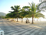
Itacoatiara beach
Itacoatiara beach

Itacoatiara is one of the 48 official neighborhoods into which the city of Niterói, Rio de Janeiro in Brazil is divided.

Excerpt from the Wikipedia article Itacoatiara (License: CC BY-SA 3.0, Authors, Images).

Itacoatiara
Avenida Beira Mar, Niterói Itacoatiara

Geographical coordinates (GPS) Address Nearby Places
placeShow on map

Wikipedia: ItacoatiaraContinue reading on Wikipedia

Geographical coordinates (GPS)

Latitude Longitude
N -22.974722222222 ° E -43.033333333333 °
placeShow on map

Address

Avenida Beira Mar
24346-000 Niterói, Itacoatiara
Rio de Janeiro, Brazil
mapOpen on Google Maps

Itacoatiara beach
Itacoatiara beach
Share experience

Nearby Places

Camboinhas

Camboinhas is one of the 48 neighborhoods into which the city of Niterói, in Brazil, is divided. The name originated in a marine accident in the 1950s. In that decade, a ship called Camboinhas grounded on the beach. A Brazilian Navy corvette named "Angostura" was sent to save the ship, but grounded during her attempts to tow "Camboinhas" out of the beach. The Navy then abandoned their attempts to salvage the "Camboinhas" and concentrated all efforts on saving the "Angostura", which they eventually succeeded in doing. Today, the remains of the hull of the Camboinhas can be seen on the beach, during low tide. The neighborhood has shores on both the Itaipu Lagoon and the Atlantic Ocean and was inhabited primarily by fishermen until 1978, when a company named Veplan started lotting the land for the real estate market. Between the years of 1980 and 1991, the place experienced a population growth rate of 14.84% per year, leading the city's statistics in that category. As a result, in 1991 it had a population of 926, which equals 0.21% of the total population of the municipality. On the Atlantic shore, the place is marked by typical vegetation of the region, with sand dunes and restinga vegetation. In terms of occupation, the area is dominated by middle and upper-class family residences. 95.51% of the houses have plumbing. Tourism: the views of Rio de Janeiro from this beach are some of the most beautiful around. It's a wonderful place to spend the day. It's about a 1 hr drive from Rio. The beach is not very crowded at all during the week, it's very swimmable and walkable, there are kiosks/little restaurants right on the beach serving snacks, full meals (great seafood) and cold drinks. It's worth staying for the gorgeous sunsets.

Charitas

Charitas is one of the 48 neighborhoods in which the city of Niterói, in Brazil is divided. The area was part of the Jesuitic Sesmaria, where the Jesuits built a cemetery and a church consecrated to Saint Francis Xavier. The name of the neighborhood derives from the Latin word caritas, meaning charity, which is inscribed on the church's door. In the 18th century, a landowner donated to the Saint Joseph Seminar, in Rio de Janeiro, the piece of land that came to be the Jurujuba Farm and upon which a mansion, known as Casarão (big house) was built. In 1853, the Saint Isabel Naval Hospital was opened and originally run by the sanitarist Francisco de Paula Cândido, in whose honor the neighborhood was first named "Paula Cândido". The hospital's function was to isolate the sick people that came with the ships that docked in Rio de Janeiro's harbor. Later, the hospital was turned into a safe house to receive children that had been infected with tuberculosis known as Preventório, after which the local beach came to be known. In the 1940s, an aeroclub was built in the area. It still exists and can handle small, private planes and helicopter landings and take-offs. The neighborhood's limits are: the waters of the Guanabara Bay, the neighborhood of Piratininga (at the Viração Hill) and the neighborhoods of Jurujuba and São Francisco (contiguous boundary). Its territory is located in the São Francisco Ensenada, which is the land comprised between the Viração Hill and the shore. The local population of approximately 3,854 (in 1991) represents 0.88% of Niterói's total population. A small chanty town exists on the Preventório Hill.

Niterói
Niterói

Niterói (Portuguese pronunciation: [niteˈɾɔj], [nitɛˈɾɔj]) is a municipality of the state of Rio de Janeiro in the southeast region of Brazil. It lies across Guanabara Bay facing the city of Rio de Janeiro and forms part of the Rio de Janeiro Metropolitan Area. It was the state capital, as marked by its golden mural crown, from 1834 to 1894 and again from 1903 to 1975. It has an estimated population of 515,317 inhabitants (2020) and an area of 129.375 km2 (49.952 sq mi), making it the fifth most populous city in the state. It has the highest Human Development Index of the state and the seventh highest among Brazil's municipalities in 2010. Individually, it is the second municipality with the highest average monthly household income per capita in Brazil and appears in 13th place among the municipalities of the country according to social indicators related to education. The city has the nicknames of Nikiti, Nicki City and the Smile City (Cidade Sorriso).Studies by the Getulio Vargas Foundation in June 2011 classified Niterói as the richest city of Brazil, with 55.7% of the population included in class A. Considering the classes A and B, Niterói also appears in the first place, with 85.9% of the population in these classes. According to data from the 2010 IBGE, Niterói's nominal gross domestic product was 11.2 billion reais, being the fifth municipality with the highest gross domestic product of the state. The city is the second largest formal employer in the State of Rio de Janeiro, although it occupies the 5th place in terms of the number of inhabitants. The city is one of the main financial, commercial and industrial centers of the State of Rio de Janeiro, being the 12th among the 100 best Brazilian cities to do business. Niterói was founded on 22 November 1573 by the Tupi Amerindian chief Araribóia, who later was forcibly converted to Roman Catholicism and given the Christian name of Martim Afonso, after the Portuguese explorer Martim Afonso de Sousa, making it the only Brazilian city to have been founded by a non-Christian, non-assimilated Brazilian Amerindian.The municipality contains part of the 2,400 hectares (5,900 acres) Serra da Tiririca State Park, created in 1991.