place

Paul's Bridge

1849 establishments in MassachusettsBridges completed in 1849Bridges in BostonBridges in Norfolk County, MassachusettsBridges over the Neponset River
Historic district contributing properties in MassachusettsMilton, MassachusettsNRHP infobox with nocatNational Register of Historic Places in BostonNational Register of Historic Places in Milton, MassachusettsRoad bridges on the National Register of Historic Places in MassachusettsStone arch bridges in the United StatesUse mdy dates from August 2023
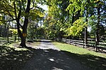
Pauls Bridge MA north side 01

Paul's Bridge is a stone bridge carrying the Neponset Valley Parkway over the Neponset River between Milton and southern Boston, Massachusetts. It was built in 1849 by Thomas Hollis, Jr., of Milton, but was later reconstructed using the original materials. It replaced the earlier Hubbard's Bridge (built prior to 1759), and a subsequent Paul's Bridge (so named at its 1807 reconstruction). Its current span is approximately 88 feet (27 m). The name "Paul" can be attributed to Samuel Paul, the owner of the adjacent land on the Readville (now Boston) side, which was part of Dedham at the time of the bridge's construction.The 1849 bridge was 81 feet (25 m) long and 22 feet (6.7 m) wide, and was constructed of unmortared Quincy granite. Each round arch measures 20 feet (6.1 m) at the springline. The area between the arches is uncoursed rubblestone, and the arches are formed out of cut granite voussoirs. The bridge underwent a major rebuilding between 1932 and 1935 under the leadership of Arthur A. Shurcliff, FASLA and founder of the AIP, who made it a priority to widen the bridge. Most of the original stone was reused and solid stone parapets replaced the wooden siderails. Instead of a rubblestone finish between the arches on the extended side, it is finished in coursed stone.Paul's Bridge was added to the National Register of Historic Places in 1972, and contributes to a historic district encompassing the Neponset River Parkway. It is located within the Neponset River Reservation, and is maintained by the Massachusetts Department of Conservation and Recreation.

Excerpt from the Wikipedia article Paul's Bridge (License: CC BY-SA 3.0, Authors, Images).

Geographical coordinates (GPS)

Latitude Longitude
N 42.234444444444 ° E -71.1225 °
placeShow on map

Address

Paul's Bridge

Milton Street
01286
Massachusetts, United States
mapOpen on Google Maps

linkWikiData (Q7148894)
linkOpenStreetMap (662205381)

Pauls Bridge MA north side 01
Share experience

Nearby Places

Readville station
Readville station

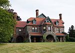
Readville station is a Massachusetts Bay Transportation Authority (MBTA) commuter rail station located in the Readville section of the Hyde Park neighborhood of Boston, Massachusetts. It is served by MBTA Commuter Rail Fairmount Line and Franklin/Foxboro Line. Readville is the outer terminus for most Fairmount service, though some trips continue as Franklin/Foxboro Line trains. The station is located at a multi-level junction, with the Northeast Corridor tracks at ground level and the Dorchester Branch (used by the Fairmount Line) above; Franklin/Foxboro Line trains use a connecting track with a separate platform. Platforms are available for the Providence/Stoughton Line on the Northeast Corridor tracks, but they are not regularly used. An MBTA maintenance and storage yard and a CSX Transportation freight yard are located near the station. Passenger service to Dedham Low Plain began in 1834 with the Boston and Providence Railroad (B&P). A branch line to Dedham was built in 1835, and the neighborhood and station were renamed Readville in 1847. The Boston and New York Central Railroad opened its Midland Branch (Dorchester Branch) through Readville in 1855, crossing over the B&P. Its station there was originally named Blue Hill, but later renamed Readville as well. Both railroads were consolidated under the New York, New Haven and Hartford Railroad in the 1890s. The New Haven built a two-level union station at Readville as part of an 1897–98 grade separation project, then constructed its Readville Shops car repair facility just to the west in 1900–03. Dorchester Branch service ended in 1944, and Dedham Branch service in 1967 when the newly formed MBTA ended its subsidies. Dorchester Branch service returned in 1979 as a Southwest Corridor construction bypass and became permanent as the Fairmount Line in 1987. The disused station building burned in a suspicious fire in 1983. The MBTA built accessible platforms and a footbridge in 1990–92. Readville 5-Yard, the former location of the 1958-closed Readville Shops, underwent decontamination in 2011–12 for reuse to allow construction of an industrial and office development.

Camp Meigs
Camp Meigs

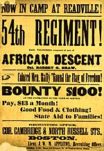
Camp Meigs is a former American Civil War training camp that existed from 1862 to 1865 in Readville, Massachusetts. It was combined from the former Camp Brigham (formed to train the 18th Regiment Massachusetts Volunteer Infantry) and Camp Massasoit (formed to train the 24th Regiment Massachusetts Volunteer Infantry) and trained the 54th Regiment Massachusetts Volunteer Infantry, among others. The 54th regiment was one of the first official African-American units in the United States during the Civil War. The former camps were merged into Camp Meigs in August 1862.Other units that trained there include the 11th, 43rd, 44th, 45th, 47th, 48th, 55th, 56th, 58th, 59th, 60th and 62nd regiments of infantry; the 1st, 2nd, 4th and 5th regiments of cavalry; the 2nd regiment of heavy artillery; and the 5th, 9th, 11th, 12th, 13th, 14th, and 16th batteries of light artillery. The 6th, 18th, 22nd, 23rd, 24th, and 26th Unattached Companies Massachusetts Volunteer Militia were also at the camp during the war. It was the busiest training camp in Massachusetts.In 1869, the land was obtained by the Norfolk Agricultural Association, improved upon, and ultimately became the Readville Race Track. On December 12, 1915, the newly formed Sturtevant Aeroplane Company tested its new A-3 Battleplane prototype on the Readville field, becoming the first American airplane engineered specifically for air combat. The A-3 was designed by Grover C. Loening, most recently the Army’s aeronautical engineer at San Diego and hired by Sturtevant. The Battleplane featured a water-cooled 140 hp Sturtevant V-8 engine with two removable 8-foot × 2.5-foot nacelles positioned mid-wing for machine gunners to fire outside the propeller arc. The test flight was piloted by Lt. Byron Jones. By World War II, the site was largely abandoned, although U.S. Navy pilots from Squantum Naval Air Station flying their Stearman biplanes would practice "touch and go" landings on the remnants of the old oval track.