Pont Pill

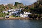
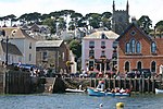
Pont Pill (Cornish: Pyll Por' Reun, meaning creek of seal cove), joins the River Fowey at Penleath Point just below the memorial to Sir Arthur Quiller-Couch at the north-east corner of Fowey harbour. Pont Pill is a tidal river and is only navigable at high water. Unspoiled by development, Pont Pill is popular with bird watchers, walkers, sailors and sport fishermen. The best way to see Pont Pill is by small boat at high water when it is possible to reach the bridge a mile-and-a-half upriver at Pont (Old Cornish: Pont Pyll, meaning bridge of the creek) the end of the navigable water. Walkers can see Pont Pill from hills that surround the river by following a section of the South West Coast Path between Bodinnick and Fowey.
Excerpt from the Wikipedia article Pont Pill (License: CC BY-SA 3.0, Authors, Images).Pont Pill
Geographical coordinates (GPS) Address Nearby Places Show on map
Geographical coordinates (GPS)
| Latitude | Longitude |
|---|---|
| N 50.334 ° | E -4.624 ° |
Address
PL23 1QL , Lanteglos
England, United Kingdom
Open on Google Maps


