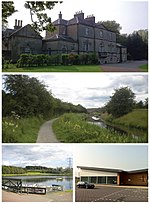
Rumford, Falkirk
Central Scotland geography stubsVillages in Falkirk (council area)

Rumford is a small village between Maddiston and Brightons in the Falkirk council area, of Scotland. The village went through a great deal of expansion in the late 1990s and early 2000s, resulting in the population increasing exponentially since the 1991 census, when it was recorded as around 275 residents. In the 2001 and 2011 censuses, Falkirk Council reported the population as being 421 and 884 respectively.
Excerpt from the Wikipedia article Rumford, Falkirk (License: CC BY-SA 3.0, Authors, Images).Rumford, Falkirk
Main Road,
Geographical coordinates (GPS) Address Nearby Places Show on map
Geographical coordinates (GPS)
| Latitude | Longitude |
|---|---|
| N 55.97505 ° | E -3.70892 ° |
Address
Main Road
Main Road
FK2 0SW
Scotland, United Kingdom
Open on Google Maps


