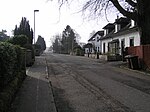
Wattston
Use British English from September 2019Villages in North LanarkshireWest of Scotland geography stubs

Wattston is a village on the B803, west of Greengairs in North Lanarkshire, Scotland. Between them Wattston and Greengairs have about 1,190 residents. It is around 4 km south of Cumbernauld, and 4 km north of Airdrie. Other places nearby include Caldercruix, Longriggend, Riggend and Slamannan. There is still open cast mining in this former mining village. The village was badly affected by the Stanrigg Mining Disaster where, in July 1918, a collapse led to the deaths of 19 local mine workers.The 98th corps of the Lanarkshire Rifle Volunteers was headquartered at Wattston.
Excerpt from the Wikipedia article Wattston (License: CC BY-SA 3.0, Authors, Images).Wattston
Greengairs Road,
Geographical coordinates (GPS) Address Nearby Places Show on map
Geographical coordinates (GPS)
| Latitude | Longitude |
|---|---|
| N 55.907777777778 ° | E -3.9583333333333 ° |
Address
Greengairs Road
ML6 7SZ
Scotland, United Kingdom
Open on Google Maps


