place

Oswegatchie River

AdirondacksCanoeing and kayaking venues in the United StatesFishing areasRivers of Hamilton County, New YorkRivers of Lewis County, New York
Rivers of New York (state)Rivers of St. Lawrence County, New YorkTributaries of the Saint Lawrence River
Oswegatchie River access at Inlet

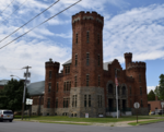
The Oswegatchie River is a 137-mile-long (220 km) river in northern New York that flows from the Adirondack Mountains north to the Saint Lawrence River. The Oswegatchie River begins at Partlow Lake in Hamilton County, New York. The river continues through Cranberry Lake which was 'doubled in size' through construction of a dam in the late 1860s. The river continues from the dam to Gouverneur, to near Talcville in St. Lawrence County, where it joins the West Branch. Much of it is within Adirondack State Park. The city of Ogdensburg developed at the mouth of the river at its confluence with the St. Lawrence.

Excerpt from the Wikipedia article Oswegatchie River (License: CC BY-SA 3.0, Authors, Images).

Oswegatchie River
Downtown Arterial Highway, City of Ogdensburg

Geographical coordinates (GPS) Address Nearby Places
placeShow on map

Wikipedia: Oswegatchie RiverContinue reading on Wikipedia

Geographical coordinates (GPS)

Latitude Longitude
N 44.6958958 ° E -75.4974483 °
placeShow on map

Address

Downtown Arterial Highway

Downtown Arterial Highway
13669 City of Ogdensburg
New York, United States
mapOpen on Google Maps

Oswegatchie River access at Inlet
Share experience

Nearby Places

Fort de La Présentation

The Fort de La Présentation (French pronunciation: [fɔʁ də la pʁezɑ̃tasjɔ̃]; "Fort of the Presentation"), a mission fort, was built in 1749 and so named by the French Sulpician priest, Abbé Picquet. It was also sometimes known as Fort La Galette (French pronunciation: [fɔʁ la galɛt]). It was built at the confluence of the Oswegatchie River and the St Lawrence River in present-day New York. The French wanted to strengthen their alliance with the powerful Iroquois, as well as convert them to Catholicism. With increasing tensions with Great Britain, they were concerned about their thinly populated Canadian colony. By 1755 the settlement included 3,000 Iroquois residents loyal to France, in part because of the fur trade, as well as their hostility to encroachment by British colonists in their other territories. By comparison, Montréal had only 4,000 residents.In 1758, with the Seven Years' War intensifying, a French-Canadian military commander took charge of a garrison at the fort. In 1759, French military forces abandoned the fort to move to Fort Lévis. Ultimately the British besieged that fort and Montréal. After the British victories of 1760, the French ceded their Canadian territory to Great Britain. The British renamed it Fort Oswegatchie. It remained under their control until 1796, after Jay's Treaty, when redefinition of the northern boundary caused the land to be taken over by the United States. The first settlement under an American flag began that year. American residents named the town Ogdensburg after early settler Samuel Ogden.