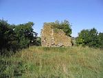
Lauderdale
BerwickshireEildon

Lauderdale is the valley of the Leader Water (a tributary of the Tweed) in the Scottish Borders. It contains the town of Lauder, as well as Earlston. The valley is traversed from end to end by the A68 trunk road, which runs from Darlington to Edinburgh.
Excerpt from the Wikipedia article Lauderdale (License: CC BY-SA 3.0, Authors, Images).Lauderdale
Geographical coordinates (GPS) Address Nearby Places Show on map
Geographical coordinates (GPS)
| Latitude | Longitude |
|---|---|
| N 55.73 ° | E -2.7488888888889 ° |
Address
TD2 6PD
Scotland, United Kingdom
Open on Google Maps


