Arnprior, Stirling
Hamlets in Stirling (council area)Stirling (council area) geography stubs

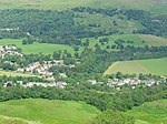
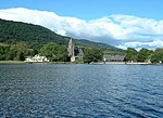
Arnprior is a hamlet in the Stirling council area of Scotland on the A811 about 12 miles west of Stirling and is one of the smallest community council districts in the region. The hamlet is next to the Flanders Moss National Nature Reserve and close to the east boundary of the Loch Lomond and Trossachs National Park, which includes the Lake of Menteith.Until 1996, the hamlet had a primary school. Due to a lack of pupils, it was shut down along with Croftamie Primary School and Kinbuck Primary School. Part of the school has since been converted into a nursery. Pupils were transferred to Buchlyvie Primary School.
Excerpt from the Wikipedia article Arnprior, Stirling (License: CC BY-SA 3.0, Authors, Images).Arnprior, Stirling
A811,
Geographical coordinates (GPS) Address Nearby Places Show on map
Geographical coordinates (GPS)
| Latitude | Longitude |
|---|---|
| N 56.126 ° | E -4.235 ° |
Address
A811
FK8 3HA
Scotland, United Kingdom
Open on Google Maps


