place

Mariemont Historic District

Historic districts in Hamilton County, OhioHistoric districts on the National Register of Historic Places in OhioNRHP infobox with nocatNational Historic Landmarks in OhioNational Register of Historic Places in Hamilton County, Ohio
Use mdy dates from August 2023
Mariemont Historic District Mariemont OH USA

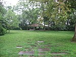
The Mariemont Historic District is a National Historic Landmark District encompassing most of the municipality of Mariemont, Ohio, USA. Mariemont was planned and developed in the 1920s by philanthropist Mary Emery and landscape architect John Nolen, and was one of the nation's first planned suburban communities. Its architecture and streetscape are still strongly evocative of its original plans. A large portion of the community was listed on the National Register of Historic Places in 1979; a larger area (fully encompassing the first listing) was designated a National Historic Landmark (as Village of Mariemont) in 2007.

Excerpt from the Wikipedia article Mariemont Historic District (License: CC BY-SA 3.0, Authors, Images).

Mariemont Historic District
Wooster Pike,

Geographical coordinates (GPS) Address Nearby Places
placeShow on map

Wikipedia: Mariemont Historic DistrictContinue reading on Wikipedia

Geographical coordinates (GPS)

Latitude Longitude
N 39.145 ° E -84.373611111111 °
placeShow on map

Address

Mariemont Historic District

Wooster Pike
45227
Ohio, United States
mapOpen on Google Maps

Mariemont Historic District Mariemont OH USA
Share experience

Nearby Places

Madisonville site
Madisonville site

The Madisonville site is a prehistoric archaeological site near Mariemont, Ohio, United States. It was listed on the National Register of Historic Places on October 16, 1974 as the "Mariemont Embankment and Village Site". Madisonville is the type site for the Madisonville phase of Fort Ancient pottery. The 5-acre site is located on a bluff above the Little Miami River about 5 miles upstream from the Ohio River. While occupied over hundreds of years, it was settled most intensively in the late sixteenth and early seventeenth centuries, and is the most excavated Fort Ancient site of this time period. Early twentieth-century excavations were carried out by staff of the Peabody Museum at Harvard University in Cambridge, Massachusetts.Since 1990, the Cincinnati Museum of Natural History has done additional studies, with findings increased by the use of current technology and professional practices. The village site was found to have had two or more small plazas, rather than just one central site, as seen at the earlier SunWatch Indian Village. This is believed to be the only Fort Ancient site whose people consumed bison as part of the game hunted to supplement their diet of maize. They may have hunted the animals in areas to the west of this site. Elk and deer were also valuable for their meat. The people also processed their bones, tendons and hides to make tools, musical instruments, clothing, and ornaments.Researchers found a large amount of goods of non-local materials and design, indicating the villagers were connected to a large exchange network. Items were identified as from the St. Lawrence River region, on the New York and Canadian border, eastern present-day Iowa, and northern Alabama, as well as Tennessee. The size and limited range of European goods indicated they came from an indirect network at this time, rather than in direct trading. People at Madisonville made distinctive snake-shaped ornaments, which have been found at other sites as distant as Iroquois settlements in Ontario, Canada and western present-day New York.

Perin Village Site
Perin Village Site

The Perin Village Site is an archaeological site in the southwestern part of the U.S. state of Ohio. Located in Newtown in Hamilton County, it is believed to have been inhabited by peoples of the Hopewell tradition.: 647 Perin Village is part of a prehistoric complex of earthworks in the Newtown vicinity; other sites in the complex include the Odd Fellows' Cemetery Mound, approximately 0.3 miles (0.48 km) to the southeast,: 646  and the large Turner Earthworks. A mound was once located at the site; when it was destroyed for the purpose of improving a roadway in the late 1870s, it yielded many bones and pieces of charcoal. Two portions of the village site are especially rich in artifacts;: 647  however, the site, 80 acres (32 ha) in total, has a less dense concentration of surface artifacts than many other sites in the region due to its location near the Little Miami River — many floods during the site's history have covered earlier artifacts with layers of silt. It is believed that a detailed excavation of Perin Village would yield evidence of houses, hearths, middens, and burial sites. A small number of "Hopewell-like" artifacts were once removed from the site by local resident Frederick Starr; his collection is now housed at the Cincinnati Museum of Natural History and Science.: 647 The archaeological value of the Perin Village Site led to its placement on the National Register of Historic Places in 1977, four years after a similar status was accorded to the Odd Fellows' Cemetery Mound.