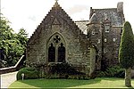
Wolfhill

Wolfhill is a village in Perthshire, Scotland, with a population of 316 (2001 census). Formerly known as Carolina, it was given the nickname of "Snipetown" many years ago by locals, owing to the high numbers of snipes that used to inhabit the area. The hamlet is near the source of the Burrelton Burn and lies between the Sidlaw Hills and the River Tay, 2 miles (3 km) north east of Guildtown and 7 miles (11 km) north-east of Perth. Close to Wolfhill are examples of pre-historic standing stones. One of the best-known sites in folklore is "The Witches' Stane" located between Wolfhill and St Martins. According to local legend, this was the stone to which Macbeth's witches were chained, and it does indeed bear chain marks. "MacBeth's Castle" (a hill fort) can be found at the nearby village of Collace, near the Council Quarry on the Sidlaws. There are varying stories on how the village got its name, one being that the "Wolf of Badenoch" (Alexander Stewart, Earl of Buchan) camped there before going to Perth in the 14th century to be officially forgiven by the church for his evil ways. He is buried at Dunkeld Cathedral in a cask. It is also said that the last wolf in Scotland was killed in Wolfhill but many other villages across the country lay claim to the same story. There is no doubt that wolves inhabited the area at one time. The monks of nearby Coupar Angus Abbey, who formerly owned the land, stipulated in certain mid-16th-century lease agreements recorded in the document known today as the Rent Book of Coupar-Angus Abbey (Rogers 1880; pages 251, 262) that tenants were required to "... sustene and nwrice ane leche of hundis for tod and wolf.." – that is to say, "...sustain and nourish a leash of hounds for (hunting) fox and wolf..". Birthplace of James Croll, FRS, joiner, janitor, librarian and arguably first world climatologist.
Excerpt from the Wikipedia article Wolfhill (License: CC BY-SA 3.0, Authors, Images).Wolfhill
Old Church Road,
Geographical coordinates (GPS) Address Nearby Places Show on map
Geographical coordinates (GPS)
| Latitude | Longitude |
|---|---|
| N 56.485091 ° | E -3.373714 ° |
Address
Old Church Road
Old Church Road
PH2 6TR
Scotland, United Kingdom
Open on Google Maps


