East Neuk
Fife geography stubsGeography of FifePages including recorded pronunciations

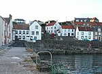
The East Neuk ( ) or East Neuk of Fife is an area of the coast of Fife, Scotland. "Neuk" is the Scots word for nook or corner, and the East Neuk is generally accepted to comprise the fishing villages of the most northerly part of the Firth of Forth and the land and villages slightly inland. It would include Elie and Earlsferry, Colinsburgh, St Monans, Pittenweem, Arncroach, Carnbee, Anstruther, Cellardyke, Kilrenny,and the immediate hinterland, as far as the upland area known as the Riggin o Fife.The area houses a Cold War era bunker near Crail. Built in the late 1950s to be a regional seat of government in the event of a nuclear war, it is now a tourist attraction.
Excerpt from the Wikipedia article East Neuk (License: CC BY-SA 3.0, Authors, Images).East Neuk
Geographical coordinates (GPS) Address Nearby Places Show on map
Geographical coordinates (GPS)
| Latitude | Longitude |
|---|---|
| N 56.243055555556 ° | E -2.7005555555556 ° |
Address
KY10 3LJ , Anstruther Easter
Scotland, United Kingdom
Open on Google Maps


