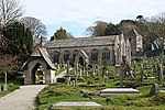
Carharrack

Carharrack (Cornish: Karardhek) is a civil parish and village in west Cornwall, England, United Kingdom. It is situated two miles (3 km) east of Redruth in a former mining area. The parish is of a rural/residential character, albeit with an industrial (mostly mining) past and relics of the past abound, primarily in the form of abandoned and broken down engine house buildings. The parish is comparatively small in area, and is bounded to the north and northwest by St Day parish, to the east and southeast by Gwennap parish, and to the southwest and west by Lanner parish.Until 1985, Carharrack was part of the parish of Gwennap but it became a civil parish in its own right with the first meeting of Carharrack Parish Council on 28 May 1985.
Excerpt from the Wikipedia article Carharrack (License: CC BY-SA 3.0, Authors, Images).Carharrack
Church Street,
Geographical coordinates (GPS) Address Nearby Places Show on map
Geographical coordinates (GPS)
| Latitude | Longitude |
|---|---|
| N 50.23 ° | E -5.182 ° |
Address
Church Street
Church Street
TR16 5QN , Carharrack
England, United Kingdom
Open on Google Maps


