Bervie Water
Aberdeenshire stubsRivers of AberdeenshireScotland river stubsUse British English from January 2017

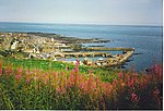
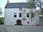
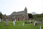
Bervie Water (Scottish Gaelic: Uisge Bhiorbhaigh) is a river in Aberdeenshire, Scotland which rises in the Drumtochty Forest and flows across The Mearns to reach the North Sea at Inverbervie. Approximately two kilometres upstream of the North Sea, the Bervie Water flows through the grounds of Allardice Castle. The Bothenoth Burn (Burn of Healing) joins the Bervie Water to the east of Arbuthnott House. At Arbuthnott the river forms a steep-sided valley where gardens were laid out on the south-facing slope. It is a series of four terraces across which run diagonal intersecting grass paths.
Excerpt from the Wikipedia article Bervie Water (License: CC BY-SA 3.0, Authors, Images).Bervie Water
Kirkburn,
Geographical coordinates (GPS) Address Nearby Places Show on map
Geographical coordinates (GPS)
| Latitude | Longitude |
|---|---|
| N 56.84391 ° | E -2.2713 ° |
Address
Inverbervie Caravan Park
Kirkburn
DD10 0RS
Scotland, United Kingdom
Open on Google Maps


