place

Adolphustown

Communities in Lennox and Addington CountyFormer township municipalities in OntarioPopulated places on Lake Ontario in CanadaUse Canadian English from January 2023
Old Hay Bay Church
Old Hay Bay Church

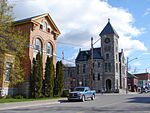
Adolphustown is a geographic area located in Greater Napanee, Ontario, Canada, on the Adolphus Reach of the Bay of Quinte in Lake Ontario. Adolphustown is now part of the town of Greater Napanee. The rural character of the Adolphustown region remains largely undisturbed today and the area, with its picturesque lakefront location, remains popular for the cultivation of apples and strawberries.

Excerpt from the Wikipedia article Adolphustown (License: CC BY-SA 3.0, Authors, Images).

Adolphustown
Highway 33,

Geographical coordinates (GPS) Address Nearby Places
placeShow on map

Wikipedia: AdolphustownContinue reading on Wikipedia

Geographical coordinates (GPS)

Latitude Longitude
N 44.063783 ° E -77.006528 °
placeShow on map

Address

Highway 33 10459
K7R 3K7
Ontario, Canada
mapOpen on Google Maps

Old Hay Bay Church
Old Hay Bay Church
Share experience

Nearby Places

Glenora, Ontario
Glenora, Ontario

Glenora is a community in the Canadian province of Ontario, on the southern shore of the Bay of Quinte at 44°02′N 77°03′W. The Bay of Quinte is a long narrow inlet on the northern shore of Lake Ontario. Glenora is a rural area located directly east of Picton, Ontario in the municipality of Prince Edward County. It serves as the western terminus of the Glenora Ferry, which connects the two shores between Glenora and Adolphustown as part of the Loyalist Parkway (Ontario Highway 33).The earliest ferry crossings at this point (originally named Stone Mills) were primarily local traffic from Adolphustown-Bath to the mills; these predate Asa Danforth Jr.'s 1802 extension of the pioneering Danforth Road (1801, Scarborough to the Trent River) to terminate at the Bay of Quinte. As colonial roads of the era were primitive, muddy and ill-maintained dirt pathways from which forest had been cleared and were often impassible, crossing at this point appears to have been sporadic until 1880, with the vessels originally powered by oarsmen and later by horses. Much traffic on the Bay of Quinte would remain local freight, such as milled grains and agricultural produce. Reliable scheduled stagecoach service only appeared after the 1817 York Road was constructed as the main post road from Toronto to Kingston via Napanee, bypassing the area. The modern ferry crossing at this point is a free car ferry operated by the Ontario Ministry of Transportation, which runs at regular 30-minute intervals year-round (and more often at peak times in summer). The crossing (one-way) takes fifteen minutes. Glenora is home to the Glenora Fisheries Station (Ontario Ministry of Natural Resources, Lake Ontario Management Unit), a research facility located on the Bay of Quinte near the ferry docks which maintains a Bay of Quinte Fisheries Management Plan and fishery management plans for Lake Ontario.Glenora and Adolphustown both remain heavily reliant on agriculture and tourism; visitors are invited to pick strawberries (in-season in early July) as well as apples at various commercial orchards on both sides of the Bay of Quinte.

Deseronto
Deseronto

Deseronto is a town in the Canadian province of Ontario, in Hastings County, located at the mouth of the Napanee River on the shore of the Bay of Quinte, on the northern side of Lake Ontario. The town was named for Captain John Deseronto, a native Mohawk leader who was a captain in the British Military Forces during the American Revolutionary War. More extensive development began with sale of village tracts by Deseronto's grandson John Culbertson in 1837. The Mohawk of the nearby Tyendinaga Mohawk Territory originally controlled the townsite as well. This is the most easterly municipality of Hastings County. It was a center of industry related to timber and mineral resources until the 1930s. In the 21st century, Deseronto, located 5 km from Highway 401, is the eastern gateway to the Bay of Quinte tourist region, with the Skyway Bridge providing access to Prince Edward County. In 1995 the Mohawk submitted its Culbertson Tract land claim to the Canadian government, which included much of the Deseronto townsite. This has provoked considerable controversy. Negotiations on this claim have been underway with the government since 2003. In June 2013 the Federal Court of Canada issued a ruling that was a declaration of federal policy, noting that expropriation of land by payment to existing property owners was among the legal alternatives for settling the land claim, together with compensation payments and acquisition of other lands for the Mohawk.