place

Marcy Village Apartments

1939 establishments in IndianaColonial Revival architecture in IndianaHistoric districts in IndianapolisHistoric districts on the National Register of Historic Places in IndianaNRHP infobox with nocat
National Register of Historic Places in IndianapolisResidential buildings completed in 1939Residential buildings in IndianapolisResidential buildings on the National Register of Historic Places in IndianaUse mdy dates from August 2023
Marcy Village Apartments

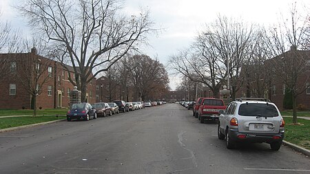
Marcy Village Apartments is a historic community located in Indianapolis, Indiana, United States. Built in 1939, the 25-acre (10 ha), 19-building apartment community compose a historic district that was listed on the National Register of Historic Places on March 24, 2004. Ground for the development was broken the week of March 20, 1939, and work was started on a full-time basis with Everett A. Carson of Indianapolis as the builder. Architects, Granger & Bollenbacher of Chicago, created the Colonial Revival apartment community for owners at the time, Marcy Realty Corporation.

Excerpt from the Wikipedia article Marcy Village Apartments (License: CC BY-SA 3.0, Authors, Images).

Marcy Village Apartments
Marcy Lane, Indianapolis

Geographical coordinates (GPS) Address Nearby Places
placeShow on map

Wikipedia: Marcy Village ApartmentsContinue reading on Wikipedia

Geographical coordinates (GPS)

Latitude Longitude
N 39.838611111111 ° E -86.134444444444 °
placeShow on map

Address

Marcy Lane 4505
46205 Indianapolis
Indiana, United States
mapOpen on Google Maps

Marcy Village Apartments
Share experience

Nearby Places

1963 Indiana State Fairgrounds Coliseum gas explosion

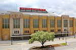
The Indiana State Fairgrounds Coliseum gas explosion took place in Indianapolis, Indiana, United States, on October 31, 1963; 81 people died and about 400 others were injured. It was one of the worst disasters in the history of the state. On the night of October 31, over 4,000 people were in the Indiana State Fairgrounds Coliseum to watch a Holiday on Ice performance. While this was happening, liquefied petroleum gas was leaking from a tank that was stored with several others in a supply room underneath a part of the grandstands. Shortly after 11 p.m. ET, the gas came into contact with an electrical heating element from the concessions area, causing a major explosion that killed many seated above the room and caused significant damage to the stands. After the initial blast, while people were evacuating, a second blast caused by the remaining, unexploded tanks caused further destruction. Firefighters and other emergency responders were at the site within minutes and survivors were transported via ambulance to various hospitals in the area. The gas tanks were discovered by firefighters during cleanup operations and later testing revealed that they were the cause of the explosion. Following the disaster, a grand jury indicted seven people in total, including employees of the gas provider and the company that operated the arena, as well as the state fire marshal and the city fire chief. However, at later dates all of the individuals either had their charges dropped or their convictions overturned. Victims of the explosion were eventually awarded $4.6 million in settlements. Several city and state agencies investigated the explosion, and it was one of the first events studied by the Disaster Research Center, a research group organized earlier that year to study large-scale disasters. The arena reopened about six weeks after the incident and still stands on the Indiana State Fairgrounds.

Oliver Johnson's Woods Historic District

Oliver Johnson's Woods is a historic district and neighborhood on the northern side of Indianapolis, Indiana, United States. Located in southern Washington Township, the district occupies the site of what was once the family farm of Oliver Johnson. Born on the present site of the Indiana State Fairgrounds, Johnson grew up in a pioneer family that lived on the edge of the state capital city. Upon attaining adulthood, he bought property a short distance to the west, to which he moved in 1846. Here, he built a larger farmhouse in 1862, and he tilled the soil for most of the rest of his life. As Indianapolis grew northward, it reached the Johnson farm in the early twentieth century; the aged farmer and his sons saw the city's growth as an opportunity for financial gain, and in 1905 they announced the platting of 0.25 square miles (0.65 km2) of their property into individual lots. They chose an advantageous time to sell their property; as the new residents began to build their homes, an interurban railway was built along College Avenue on the district's western side that connected downtown with Broad Ripple. Many prosperous businessmen were attracted by the development's large lots and wooded streets; the city annexed Oliver Johnson's Woods in 1912, and by the outbreak of World War II, the streets were filled with large houses built in a wide variety of architectural styles. These early residents came from many different ethnicities: European immigrants were becoming more prosperous and leaving their ethnic enclaves, and new neighborhoods such as Oliver Johnson's Woods appealed to them. Among the neighborhood's leading residents was a colony of Jews of German descent.Houses in the district generally feature architectural styles that were popular in the early twentieth century, such as the Colonial Revival, the Tudor Revival, the Arts and Crafts, the American Foursquare, and the Prairie School. Many of the district's Colonial Revival houses were constructed by William F. Nelson, who acted both as architect and as general contractor for these projects. Standing out from all other houses in the district is the original Johnson farmhouse; now known as the Johnson-Denny House, it originally faced Central Avenue, but its new owner relocated it to face Park Avenue while the surrounding land was being developed in 1919. Other buildings were once located around the house, but they have not survived.Today, Oliver Johnson's Woods is surrounded by the Meridian-Kessler neighborhood, and it remains the wooded middle-class neighborhood that it was originally planned to be. In 1979, the Johnson-Denny House was listed on the National Register of Historic Places; it was seen as eligible because of its place in local history and because of its well-preserved historic architecture. Twenty-five years later, all of Oliver Johnson's Woods was designated a historic district and added to the Register because of its architecture and local historical importance. The area designated as historic encompasses approximately 40 acres (16 ha); ninety-two different buildings within this zone qualified as contributing properties. Ninety of these buildings are houses; a 1999 historic preservation survey conducted by Indiana Landmarks ranked four of them as "outstanding," seventeen as "notable," and the other sixty-nine simply as "contributing."