place

Fresno Yosemite International Airport

Airports in Fresno County, CaliforniaCalifornia in World War IIPages with disabled graphsPublic transportation in the San Joaquin Valley AreaTransportation in Fresno, California
Use American English from September 2020Use mdy dates from December 2020
Fresno Airport aerial

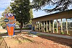
Fresno Yosemite International Airport (IATA: FAT, ICAO: KFAT, FAA LID: FAT) is a joint military–public airport in Fresno, California, United States. It is the primary commercial airport for the San Joaquin Valley and three national parks: Yosemite, Sequoia and Kings Canyon. It offers scheduled passenger flights to several major airline hubs in the United States and international service to Mexico. The facility opened in June 1942 as Hammer Field, a military airfield. The airport is owned and operated by the city of Fresno and operates two runways on a property spanning 1,728 acres (699 ha). Its airport code "FAT" stands for Fresno Air Terminal, a former name for the airport. Due to its central location within the state, the airport is home to several military, law enforcement, firefighting, and medical air units. The Fresno Air National Guard Base on the southeast corner of the airport is home to the 144th Fighter Wing of the California Air National Guard. The Fresno Air Attack Base on the eastern side of the airport supports aerial firefighting aircraft. Other government and military operators with facilities at the airport include the California Army National Guard, the California Highway Patrol, the Fresno County Sheriff's Office, and the Fresno Police Department. Fresno is home to a large operations base for SkyWest Airlines, the nation's largest regional airline.

Excerpt from the Wikipedia article Fresno Yosemite International Airport (License: CC BY-SA 3.0, Authors, Images).

Fresno Yosemite International Airport
Peach Avenue, Fresno

Geographical coordinates (GPS) Address External links Nearby Places
placeShow on map

Wikipedia: Fresno Yosemite International AirportContinue reading on Wikipedia

Geographical coordinates (GPS)

Latitude Longitude
N 36.776666666667 ° E -119.71888888889 °
placeShow on map

Address

Fresno Yosemite International Airport

Peach Avenue
93612 Fresno
California, United States
mapOpen on Google Maps

linkWikiData (Q2720229)
linkOpenStreetMap (44175786)

Fresno Airport aerial
Share experience

Nearby Places

Radio Bilingüe

Radio Bilingüe is a non-profit public radio network with Latino control and leadership, is the only United States national distributor of public radio programming in the Spanish language. It is based in Fresno, California.This satellite network was formed to provide stations with news, information, and cultural programming in Spanish and musical programs showcasing a variety of Latino formats with emphasis on Mexican folk and Afro-Caribbean rhythms. Satélite Radio Bilingüe builds on Radio Bilingüe's decades-old tradition of talk programs, special events coverage and its flagship news service, Noticiero Latino, for stations across the United States, Puerto Rico and Mexico. Radio Bilingüe is the recognized Spanish-language radio service for the public radio system in the United States. It serves over half a million listeners with its pioneering daily Spanish-language national talk show, Línea Abierta, its independently produced news service, Noticiero Latino, and its rainbow of Spanish-language folk music for its national Latino audiences. The entire 24-hour daily operation is totally devoted to public service. Radio Bilingüe has a full-time staff of twenty-five and a budget of two million dollars. Its funders include the Robert Wood Johnson Foundation, The California Endowment, the David and Lucile Packard Foundation, the Corporation for Public Broadcasting, the National Endowment for the Arts, the California Arts Council, the California State Health Department - Tobacco Control Section, and many other funding partners interested in informing hard-to-reach, low-income, Latino populations in California and across the U.S.