place

Camp Lincoln (California)

1862 establishments in CaliforniaAmerican Civil War army postsCalifornia Historical LandmarksCalifornia in the American Civil WarClosed installations of the United States Army
Crescent City, CaliforniaForts in CaliforniaHistory of Del Norte County, CaliforniaUse American English from January 2023Use mdy dates from January 2023
CampLincoln1862 CrescentCityCA

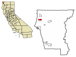
Camp Lincoln (also known as Long's Camp, Fort Long, Lincoln's Fort, or Fort Lincoln), in Crescent City, California, was a United States military post. It was established June 13, 1862, by the men of Company G, 2nd Regiment, Infantry, California Volunteers to keep peace between the Tolowa tribe of Native Americans and the miners and settlers of northwestern California. When the California Gold Rush began, people from all over the country ran to Gold Country to try to make their fortunes. Likewise in northwestern California, many men headed that way, leaving their wives, children, and homes. The Tolowa were being forcibly resettled in the region and were beginning to take their vengeance on those who stayed behind. Settlers petitioned the Army for protection, but their pleas were not well received by the Department of the Pacific, whose troops were already stretched thin from protecting stagecoach travelers. However, the petitioners eventually got their wish, and Fort Ter-Waw was established. After that was destroyed by the Great Flood of 1862, the troops were moved to Camp Lincoln. In September 1862, the camp was moved six miles (10 km) north of the city to a more neutral position further away from the settlers. During construction of the new location, tensions between the whites and the Tolowa rose even further. Many of the whites wanted the government to evict the Tolowa, but the government did no such action and they began to take matters into their own hands. Settlers burned crops and harassed the Tolowa, who were told to get out or be killed. Approximately 500 Tolowa decided to leave, and the remaining 1,500 stayed only because the Army promised to keep the peace. Although no truce was reached, after the Civil War, the Army could not afford to staff many small posts, and the camp was abandoned in June 1869 and closed for good in May 1870. Commanding officer's quarters and one barracks remained when the site was declared California Historical Landmark #545 in 1962.

Excerpt from the Wikipedia article Camp Lincoln (California) (License: CC BY-SA 3.0, Authors, Images).

Camp Lincoln (California)
Kings Valley Road,

Geographical coordinates (GPS) Address Nearby Places
placeShow on map

Wikipedia: Camp Lincoln (California)Continue reading on Wikipedia

Geographical coordinates (GPS)

Latitude Longitude
N 41.819847 ° E -124.135853 °
placeShow on map

Address

Kings Valley Road 4270
95531
California, United States
mapOpen on Google Maps

CampLincoln1862 CrescentCityCA
Share experience

Nearby Places

Lake Earl
Lake Earl

Lake Earl is a lagoon on the extreme northern California coast, just south of the Oregon border. A navigable body of water, it lies partly within Tolowa Dunes State Park and partly within Lake Earl Wildlife Area in Del Norte County, California and the third-most important seabird area on the West Coast after the Farallons and the Channel Islands.Lake Earl has two principal lobes separated by "the Narrows." The smaller lobe, which is also closer to the ocean and the sand bar breach site, is called Lake Tolowa or Lake Talawa by the California Department of Fish and Game. The larger lobe of the lagoon is Lake Earl. Lake Earl is mostly freshwater while Lake Tolowa has a higher salt content. As opposed to an estuary, which is typically open to the ocean and fresh water constantly, a lagoon seals up seasonally and fills with a predominance of fresh water. The lagoon, located on the coast of California about 11 miles (18 km) south of the border with Oregon, is manually breached when the water levels rise to 8 feet (2.4 m) to 10 feet (3.0 m) mean sea level (MSL). Though references to levels on USGS charts are made relative to Mean Lower Low Water (MLLW) leading to difficulty over the management of the lake's levels. If allowed to breach naturally, the water surface would rise to 12 feet (3.7 m) to 14 feet (4.3 m). At 10 feet (3.0 m) MSL there is approximately 4,900 acres (20 km2) of water surface in the lagoons and 4,950 acres (20.0 km2) of wetlands; at 8 feet (2.4 m) MSL, the surface waters area is approximately 4,200 acres (17 km2). At 2 feet (0.61 m) MSL, the combined surface area is a mere 2,191 acres (8.87 km2) of open water surrounded by 2,000 acres (8.1 km2) of wetlands. Lake Earl is largest coastal lagoon in California. Due to the remoteness and natural environment of the area, the lake is often used for birders and is locally popular with duck hunters. Fishing for cutthroat trout is also a common use. The lake is lightly used by kayakers. Water skiing is prohibited.

Achulet massacre

The Achulet Massacre refers to the 1854 massacre of an estimated 65-150 Tolowa Indians at the hands of European-American settlers. The incident occurred at the village of Achulet (Tolowa: ‘Ee-chuu-le’), near Lake Earl in [what is now Del Norte County Del Norte County), California. During the same time (from 1845 to 1855), the Tolowa people were forcibly relocated to what they refer to as the “Klamath Concentration Camp”, only to later be relocated to Indian reservations in Oregon in 1860 after the Rogue River Wars. The village of Achulet was developed into a huge shipping and trade center. Its development can be attributed to the extensive migration of Europeans into California from 1845 to 1855, most of whom were prompted to travel there by the California gold rush. However, the arrival of these Easterners resulted in a visible decline of the Tolowa population. In addition to genocide, the decline in Tolowa population can also be attributed to contracting diseases that were introduced by the European-American settlers.The Anglo people were also eager to acquire land occupied by the Tolowa. This led to a very brutal encounter between the two groups. An Indian was suspected of stealing the horse of a white man. In response, armed whites hid in the brush near the village at night, agreeing not to shoot until the Tolowa left their dwellings in the morning. At daybreak the whites fired as soon as someone emerged into the village, and then the men, women, and children of the village were "shot down as fast as the whites could reload their guns". Some Tolowa tried to escape into Lake Earl; armed whites pursued them, shooting whenever the Tolowa showed above the waterline. The attackers reported killing 65 Indians, but this tally did not include victims whose bodies sank in the lake. After the attack, the settlers renamed the village as Pay Way, after Old Pay Way, one of the few Tolowa survivors.