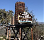
Sugar Pine, California
Sugar Pine is an unincorporated community in Madera County, California. It is located 5 miles (8 km) north of Yosemite Forks, at an elevation of 4236 feet (1291 m). It is located 1 mile east of California State Route 41, between Oakhurst, California and the South Entrance of Yosemite National Park. Sugar Pine was built by the Madera Sugar Pine Company in 1899 to 1900. The company which had an extensive logging operation in the area between the 1890s and 1931. The mill pond and some service buildings are all that remain of the mill. The company housing units, over the years updated, are still in use today as residences and vacation homes. A post office operated at Sugar Pine from 1907 to 1934.
Excerpt from the Wikipedia article Sugar Pine, California (License: CC BY-SA 3.0, Authors).Sugar Pine, California
Road 630,
Geographical coordinates (GPS) Address Nearby Places Show on map
 Continue reading on Wikipedia
 Geographical coordinates (GPS)
| Latitude | Longitude |
|---|---|
| N 37.441111111111 ° | E -119.63444444444 ° |
Address
Road 630
Road 630
California, United States
Open on Google Maps