place

Whately, Massachusetts

Massachusetts populated places on the Connecticut RiverSpringfield metropolitan area, MassachusettsTowns in Franklin County, MassachusettsTowns in MassachusettsUse mdy dates from July 2023
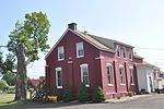
Whately Milk Bottle
Whately Milk Bottle

Whately (; WAIT-lee) is a town in Franklin County, Massachusetts, United States. The population was 1,607 at the 2020 census. It is part of the Springfield, Massachusetts Metropolitan Statistical Area.

Excerpt from the Wikipedia article Whately, Massachusetts (License: CC BY-SA 3.0, Authors, Images).

Whately, Massachusetts
Chestnut Plain Road,

Geographical coordinates (GPS) Address Nearby Places
placeShow on map

Wikipedia: Whately, MassachusettsContinue reading on Wikipedia

Geographical coordinates (GPS)

Latitude Longitude
N 42.433333333333 ° E -72.633333333333 °
placeShow on map

Address

Chestnut Plain Road 141
01066
Massachusetts, United States
mapOpen on Google Maps

Whately Milk Bottle
Whately Milk Bottle
Share experience

Nearby Places

Whately Center Historic District

The Whately Center Historic District encompasses the historic rural village center of Whately, Massachusetts. Located in the hills west of the Connecticut River and north of Northampton, the district consists of a stretch of Chestnut Plain Road, the main north-south route through the village, and a short stretch of Haydenville Road, which is roughly at the center of the district. There are many fine homes from the Federal period, although they often have embellishments from later periods. Greek Revival architecture is also a major presence, with numerous houses, as well as the town's civic centerpieces, the town hall (c. 1844) and Second Congregational Church (c. 1843), showing that style. There are only a modest number of 20th century structures in the district bounds. The district was listed on the National Register of Historic Places in 2003.The area that is now Whately was Native American land until its purchase by English colonists from Hatfield in the late 17th century. Some farming took place then, but settlement was delayed by King Philip's War (1675–78). A land division in 1684 included provision for what is now Chestnut Plain Road, but settlement remained slow, with many early homes surrounded by wooden palisades. The archaeological remains of one such palisaded homestead remain in Whately Center. The town was separately incorporated in 1771, the date the center cemetery and its surviving animal pound were established. Only one house, the c. 1760 Morton House at 207 Chestnut Plain Road, predates the town's incorporation.

West Whately Historic District

The West Whately Historic District is a historic district encompassing over 700 acres (280 ha) of western Whately, Massachusetts. The area, located in the foothills of The Berkshires above the Connecticut River, has a long agricultural history, but also experienced a surge of industrial activity in the 19th century, of which only fragments remain. The district, listed on the National Register of Historic Places in 2003, is focused on the areas surrounding West Brook and the areas where there was once industrial activity. From the late 18th century into the early 20th, there were some 16 mill complexes in the area, of which only one still has a surviving structure. The principal elements that survive of this industrial past are foundations and evidence of water works such as dams and millraces. There are only two institutional buildings in the district: the West Whately Chapel, built in the Queen Anne style in 1896, and a schoolhouse that has since been converted to a residence.The oldest documented mill privilege on West Brook was granted about 1765 to Edward Brown, who operated a sawmill with his sons. This mill site was active into the 1920s, and was probably one of the longest-lived industrial sites. Privileges granted in the 1780s include one that was initially used for an oil mill, and another that included both grist and saw mills. At the mid-19th century, the area was that of the largest non-agricultural employment in the town, and also had several shops. The water-powered industries suffered due to reduced waterflows after the Northampton Reservoir was built in 1901, and most of the buildings were gone by the 1920s.

Bradstreet Historic District

The Bradstreet Historic District encompasses the rural 19th-century village of Bradstreet in Hatfield, Massachusetts. It is centered at the junction of Depot Road and Main Street, and includes properties lining those two streets and Old Farm Road. Most of the buildings in the area date to the second half of the 19th century, featuring architectural styles typical of the period, including Queen Anne, Second Empire, Italianate, and Colonial Revival. The village grew on land that was originally granted to colonial governor Simon Bradstreet and divided in 1682, and has remained largely agricultural since then. The district was listed on the National Register of Historic Places in 1997.The Bradstreet village is located in northeastern Hatfield, occupying an area that is mostly within the floodplain of the Connecticut River just south of the border with Whately. Main Street and Depot Road are the principal roads in the area, the former roughly paralleling the river, and the latter extending west toward North Hatfield. Between Main Street and the river lie several farm access lanes, Old Farm Road and Bashin Road among then, that are mainly lined with agricultural buildings. A large number of these are barns for the curing of tobacco, a major crop in the region in the 19th and 20th centuries. Most of the built architecture of the area dates from the late 18th to early 20th century; the major exception is a 20th-century subdivision on Cronin Hill Road. The largest number of houses date to the mid-19th century, with a number of modestly styled examples of Greek Revival architecture. There are a few houses that are Italianate, and a larger set of Colonial Revival and Craftsman/Bungalow houses.

Upper Main Street Historic District (Hatfield, Massachusetts)

The Upper Main Street Historic District is a predominantly residential historic district in northeastern Hatfield, Massachusetts. Unlike Hatfield Center, which dated to colonial days and lies south of the district, this part of Hatfield developed roughly between 1860 and 1939 as a village centered on the nearby ferry landing on the Connecticut River. The district includes properties in a roughly triangular area bounded by Main Street, King Street, and North Street, and features a large number of Colonial Revival, Queen Anne, and bungalow-style houses. The district was listed on the National Register of Historic Places in 1994.The town center of Hatfield was laid out in 1661, with narrow house lots facing the main road, and large agricultural areas surrounding the village. The southern portion of this district includes a portion of the original town plan, which is still evident in the placement of houses and surrounding land use. In addition to the residential buildings lining its roads, the district also includes agricultural buildings related to the area's historic patterns of agriculture. Prominent among these are several tobacco barns, reflecting the importance of that crop in the town's 19th century economic prosperity. There are also several surviving livestock and horse barns, of which one of the former dates to about 1800. The oldest house in the district, the Jeremiah Bardwell House at 108 Main Street, is of similar vintage, dating to about 1790.

Sunderland Center Historic District

The Sunderland Center Historic District encompasses the historic center of the farming town of Sunderland, Massachusetts, on the plains of the Connecticut River. The multi-acre district runs along North and South Main Street (Massachusetts Route 47), roughly from Old Amherst Road to North Silver Lane, and includes Bridge Street and the Sunderland Bridge across the river. The properties in the district largely still follow the plan of the town when it was first laid out in 1714. The predominant architectural style in the district is Greek Revival, but there are fine examples of Georgian and Federalist architecture, as well as a number of late 19th and early 20th century architectural styles. The district was listed on the National Register of Historic Places in 2002.The area that became Sunderland was occupied by Native Americans until the 1670s, when it was purchased from them by English settlers; the single largest purchased traded much of the land for 80 fathoms of wampum. The settlement, known as Swampfield, was abandoned during King Philip's War (1675–78), and was not reestablished until 1714. At that time, Main Street was laid out along what had been a Native American trail, with a width of eight rods, and land parcels with frontage of fourteen rods were allotted to settlers. Land for the town cemetery was set aside, as was common land and a parcel for a minister. This basic plan is still visible in the lot divisions of the town center, although most of the lots have been divided, halving their frontage.